

Midwinter Ride across the Tahuya Hills
In Seattle, we are lucky: We can cycle year-round. Rarely is it so cold or so icy that cycling becomes difficult. Our cycling season usually starts with the new year. “What about the rain?” you may ask. It’s not a big deal if you have the right equipment.
Last weekend was the middle of winter – halfway between the winter solstice and the spring equinox. It was a good excuse to celebrate with a bike ride. The weather forecast was for ‘showers’ – as good as it gets around here this time of the year. At least we wouldn’t get snow like we did when we ventured into the mountains last week!
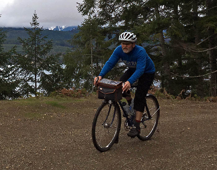
Busy schedules meant that only two of the BQ Team could make it. Steve and I met at 6 a.m. to take the ferry to Bremerton. We rolled on quiet backroads through the hills to Belfair.
There we had a second breakfast – knowing that this was the last opportunity to obtain food for a few hours.
From here, we headed into the Tahuya Hills. To me, even the name sounds romantic, and the hills always live up to our expectations.
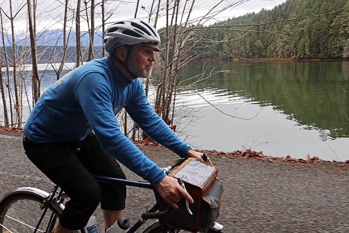
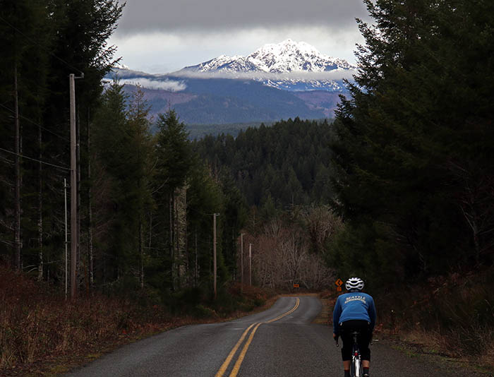
North Shore Road goes along the water of the Hood Canal, a fjord carved by the glaciers of the last ice age. On the other side are the Olympic Mountains, but on this cloudy, rainy day, we only saw glimpses of the snow-covered peaks.
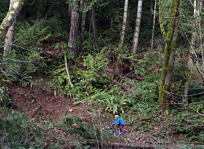
It’s an amazing gravel road that winds its way in and out of the many little ravines in the mountainside.
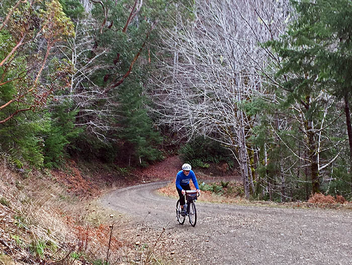
At the same time, the road is relentlessly hilly – it was built with minimal earthworks because it wasn’t worth making big improvements for a road that sees very little traffic. This combination of attributes – minimal ‘improvements’ and little traffic – made it perfect for our ride!
[youtube https://youtu.be/ubclniV3_KA?rel=0&w=640&h=360]
It’s a course that challenged our leg power as much as our bike handling skills. The road dives into each ravine, turns sharply, and immediately heads steeply uphill again. The more speed we carried through those gravel turns, the less we had to pedal on the next hill.
![]()
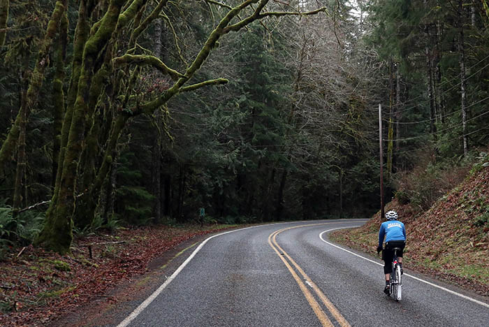
Back on pavement after a few hours, we climbed high above the water, only to drop back down and roll along the shore. It was great fun.
The clouds opened briefly to hint at the views we would have enjoyed on a sunny day. We smiled at each other as we got in the aero tuck to maximize our speed on the downhill, remembering at the last second that the turn at the bottom has a wickedly decreasing radius, which caught both of us out the first time we rode it. No problem today: The low-trail geometry of my bike allowed easy midcorner adjustments of my line.
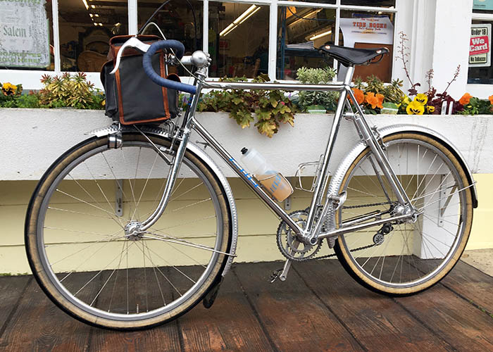
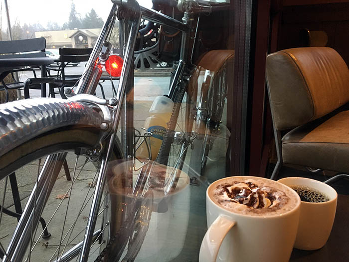
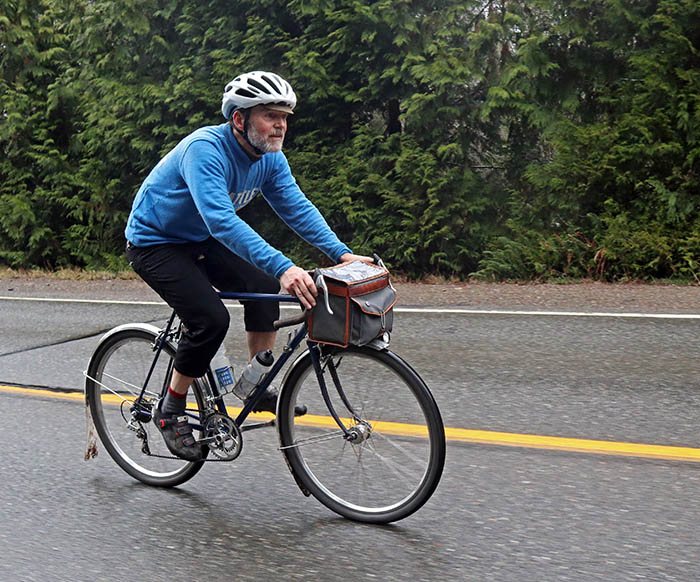
After a few hours of riding on deserted roads, we reached Seabeck on the other side of the Tahuya Hills, where we enjoyed a sandwich at the store. It had been raining on and off, and the gravel was a bit muddy, but you’d never know it from looking at our bikes. Remembering the days when we rode with plastic fenders, it never ceases to amaze me how clean and dry both rider and bike remain with a set of really good fenders. There only was a little dirt on the fork blades where the brake pads had sprayed the water they had scraped off the rims. The chain didn’t squeak, and my feet remained dry even though I didn’t wear booties.
Steve was riding his Frek, the old Trek he converted into a randonneur bike, with similar features as my bike. Neither of us even bothered putting on rain jackets, because we would have overheated on the steep climbs. Keeping the road spray off our bodies was key; our layered wool jerseys took care of the comparatively little water that was falling from the sky.
The hardest part of the ride was yet to come: the incredible Anderson Hill Road with its 14% stairstep climb. We made it up that just fine, and then we upped the pace on the last few miles back to Bremerton.
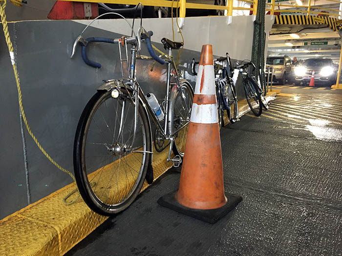
We boarded the ferry, parked our bikes, and enjoyed the scenic boat ride through the islands back to Seattle.
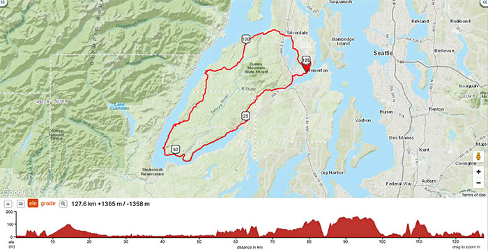
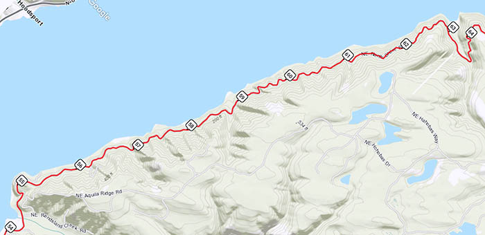
The Tahuya Hills course makes a beautiful 80-mile ride that goes along the water for much of the way. It sees very little traffic apart from the first and last kilometers near Bremerton. Easily accessible from downtown Seattle via a direct ferry, it’s a ride I highly recommend!
Click here for a link to the RideWithGPS route with a detailed map of the course.
