

Jan Sets FKT on Oregon Cascades Volcanic Arc
“What is the hardest ride you’ve done,” I sometimes get asked. Usually I demur. I ride to discover beautiful places, to enjoy the flow of beautiful climbs and descents (on gravel or pavement)—and, yes, to explore the limits of what my body (and mind) are capable of doing. But I don’t seek out suffering.
And then comes along the Oregon Cascades Volcanic Arc, a 413-mile bikepacking route that traces the crest of the Cascade Mountains. Until now, nobody had attempted an FKT (Fastest Known Time) in the six years since Ryan Francesconi scouted this route. I think there are many reasons. Obviously, any route that hugs the crest of this great mountain range will be mostly up and down, so it’s challenging. Ryan also has a penchant for including single-track and abandoned wagon trails in his routes—which may or may not be passable at any given time. (In fact, during my ride, I found two bridges missing.) And then there is the weather. When the snow finally melts on the high passes, summer heat often reaches 95°F (35°C) or more. In fact, I was planning to ride the route last year… Apart from a narrow window during a heat wave in July, forest fires closed various parts of the route all summer. When the fires were finally out, snow was already falling again.
This year, I was determined not to miss my opportunity. Scheduling conflicts meant that I had to go a bit earlier than even Ryan considered wise. It was a case of ‘now or never’—or at least that’s what it felt like after last year. If I had to hike through the occasional snow patch and climb over the occasional fallen tree, so be it.
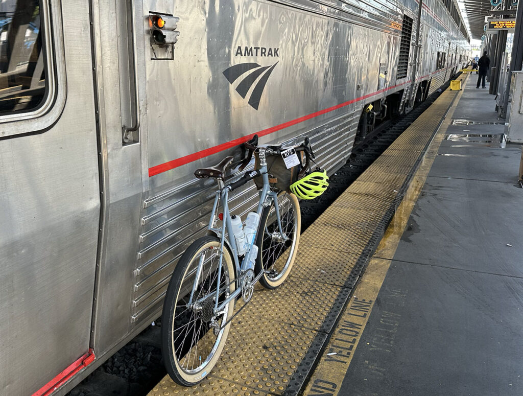
And so I boarded the train to Klamath Falls last Saturday. As to the bike, I decided to take the Rene Herse we built for the Oregon Outback. For a ride into the unknown—and with the potential of being dragged through wet snow for extended periods of time—an analog bike is my first choice. During last year’s Unbound XL, the electronic derailleur on my other 26″ bike stopped working after a creek crossing, until I removed the battery and wiped it dry. The idea of being stuck in a single gear on a ride with this many ups and downs is not appealing. (Apologies to single-speeders.) The Nivex derailleur on this bike doesn’t have any cable housing, nor a return spring—just open cables all the way from the shifter to the derailleur—so it shrugs off even extended exposure to mud and water.
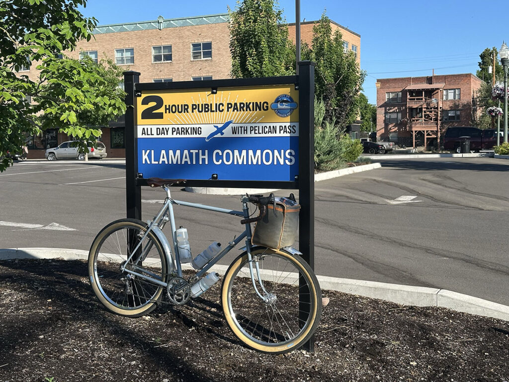
After arriving at midnight in Klamath Falls, I rode over to Klamath Commons the next morning—the official start of the ride. It’s just a block from the iconic Maverick Hotel where I spent the night. (I also slept on the train to get some rest after a busy week.)
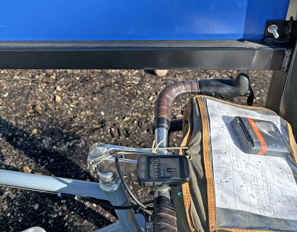
8 o’clock: Time to head out for my adventure! This is one of the best moments of any ride: Heading into the warm morning sunshine, with nothing to do for the next few days except ride my bike through some of my favorite landscapes. All doubts and uncertainties fall away at this moment: I’m on my way, and I’m loving it!

Unlike the Oregon Outback route that goes east of the Cascade Mountains, the OCVA hugs the crest of the great mountain range. It starts climbing right away. Looking back, I see Klamath Lake below, and Mount Shasta in the distance, glinting in the morning sun. I am far, far south from Portland! The enormity of my task is suddenly becoming into focus. But rather than dwell on what lies ahead, the beautiful views (and the steep climb) kept my mind focused on the present.
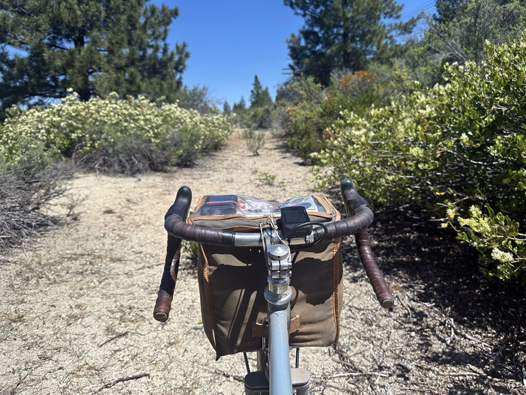
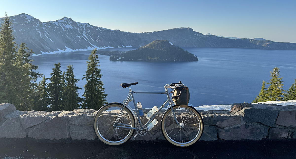
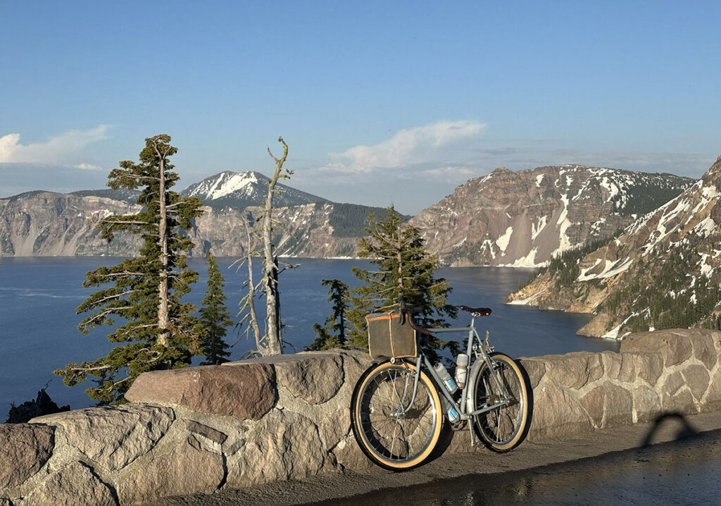
I’m heading to Crater Lake. This giant volcanic crater was formed when ancient Mount Mazama exploded about 7,000 years ago. In fact, I’ve been riding on the yellow ash from that volcanic eruption for a while now: Many gravel ‘roads’ that Ryan chose for his route are just tracks where the sagebrush has been cleared so a four-wheel-drive truck can pass. The best way to keep the bike from sinking into the loose and sandy surface is to keep the speed up—and the tire pressure down. I’m running 21 psi (1.4 bar) in my 54 mm Extralight tires, set up with TPU tubes to minimize rolling resistance and weight. Any lower pressure, and I’d risk bottoming out on the rough night-time gravel descents as the route zig-zags across the Cascade Mountains time and again.
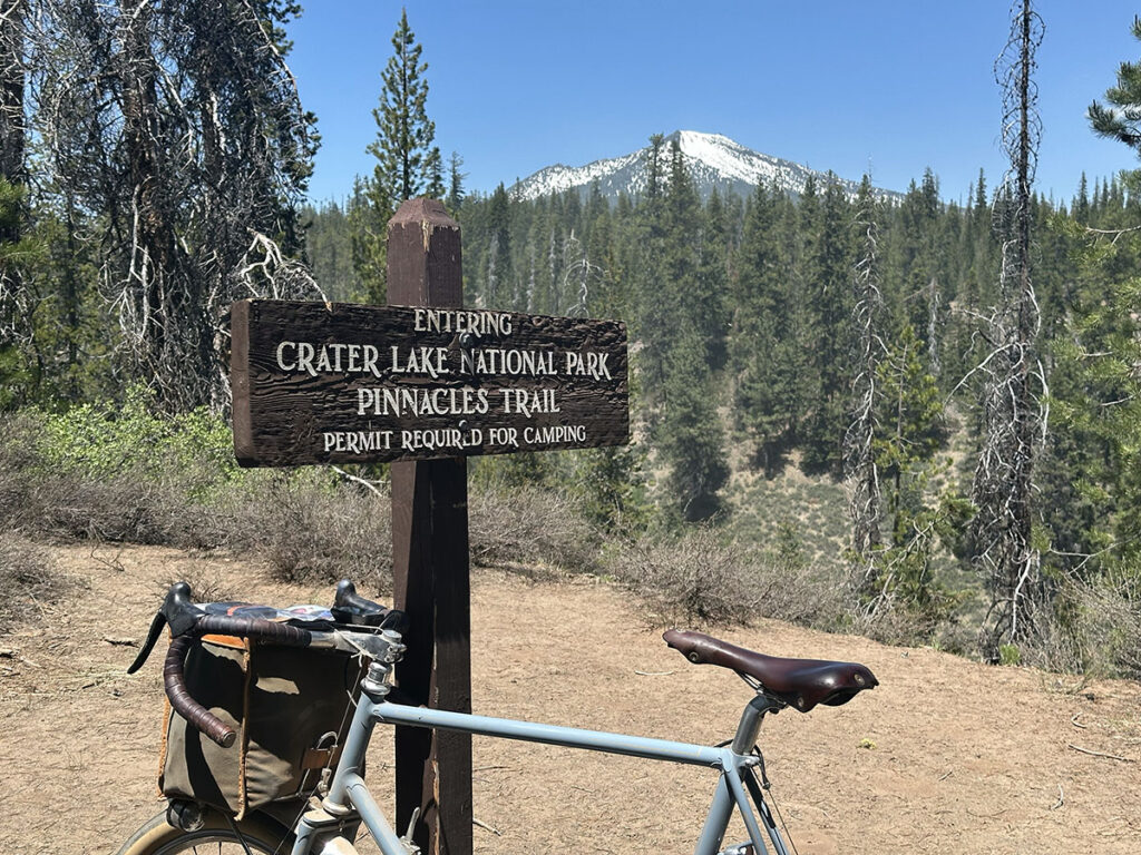
Empty gravel roads that climb gently up the lower slopes of the volcano make for great riding. I haven’t seen a car since I left pavement many hours ago. I enter the National Park at the no-longer-used south entrance. Coincidentally, that is where I see the first patch of snow by the roadside. Will the route be passable, even if it’s not rideable all the way? That is the big question of this ride…
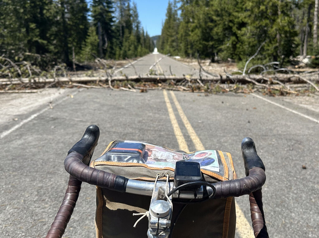
As I climb the paved road that will allow visitor to reach this area of the park once the snow has melted, I encounter occasional trees that have fallen onto the road. After quick cyclocross-style dismount, I lift my bike over the tree, then scamper across the trunk, before remounting—all with a minimum of time lost. When I turn around a bend, I see that the road ahead is white. Snow!
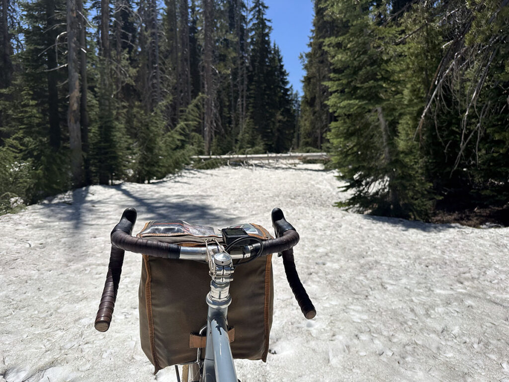
Just before I reach the snow, the route turns off onto the gravel Grayback Trail. It’s even more snowy there—not only requiring a hike-a-bike, but it also making it difficult to follow the trail. For the next 4.5 hours, I am pushing and carrying my bike. I cover 7 miles (11 km) that way. I get lost when my GPS shows me on course when I’m actually hiking in the forest, away from the trail.
Why don’t I turn around and use the bypass that Ryan mapped out? Well, that would add roughly 40 miles to the route. And as so often, the snow patches seem small enough at first, but even a small increase in elevation and change of exposure can dramatically change the snowpack. It’s easy to get lured in, and then find myself hiking on top of 6 feet (1.8 m) or more of snow. Fortunately, I am prepared—if necessary, to spend a night in the snow—because I don’t want to take risks (and certainly hope to never push the ‘SOS’ button on my tracker because of my own stupidity).
Spending 50 minutes back-tracking and trying to find the route again is definitely not part of the plan. I learn not to be lured into complacency by the GPS showing me on course. When the satellite signal is spotty, the Wahoo apparently assumes you are moving along the course without knowing for sure. I wish my dot would at least flash to alert me that it’s just a guess. I’ll investigate how to download the topo map data when saving a route for off-line use—otherwise all I get is a blue dot on a green background, but no information whether the course is uphill or downhill from where I am. In the end, I clamber up a steep slope with my bike on my shoulder to get back on route.
Four-and-a-half hours of hiking is a long time, but it passes quickly when you’re working hard. The reward is a view of the crater in the evening light. I’m just as excited that the cafeteria at the visitor center is still open. I’ve been melting water in my bottles for hydration, but a real resupply is definitely welcome before a night in the mountains. With my bag and bottles well-stocked, I can finally enjoy the views. At 7,700 ft (2,350 m), I feel on top of the world. Even the setting sun is lower than my elevation.
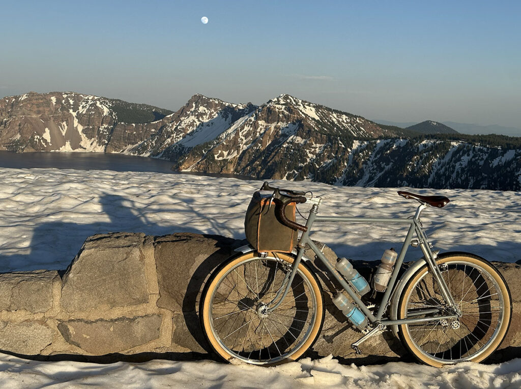
The full moon will be a welcome companion, and the nights are short this time of day. Unexpectedly, I encounter more snow on the rim of Crater Lake and then, in the middle of the night, in the Calapooya Mountains. Neither Ryan nor I even considered the possibility of snow here, but this year’s snow pack is larger than usual, and the route climbs back up to 5,700 ft (1,750 m) here.
Once I break out of the snow and start the monster 5,000 feet (1,500 m) descent to Oakridge, I’ve hiked through 11 miles (18 km) of snow and spent 6 hours doing so. My legs and hips are a bit sore because I haven’t trained for lopsided walking while pushing my bike. Fortunately, my bike is none the worse for wear. Only the rear brake doesn’t completely release, as there’s some dirt inside the cable housing. I only notice it because my brake lever rattles a bit—it doesn’t slow me down. The shifting is as crisp and quick as it was when I started the ride. There are no grinding noises, and my chain is running smoothly.
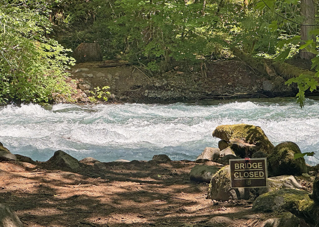
The night sees more beautiful climbs. Fifteen miles of single-track along the McKenzie River are designed for full-suspension mountain bikes and push my rando bike to the limit. And then I find that the bridge at the end of the trail has gone missing, and I have to backtrack a few miles of the roughest trail to find a detour.
I hit the infamous 22% gravel climbs during the heat of the day. Arriving at Clear Lake, the thermometer at the Forest Service lodge shows 97 degrees (36° C). There I find park rangers who look like angels to me: They serve home-baked strawberry rhubarb pie and add extra helpings of ice cream to help me to cool down and refuel. With energy and enthusiasm replenished, I bush-whack through long-abandoned wagon roads—and ford a creek where another bridge has gone missing.
The second night sees me cross the crest of the Cascade Mountains on gravel roads one more time. The descent seems to go on for hours, which feels like my mind is playing tricks—until I check the tracker after the ride, and it shows a solid hour of steep descending on gravel at high speed. Ryan has designed a route that’s extreme in every way.
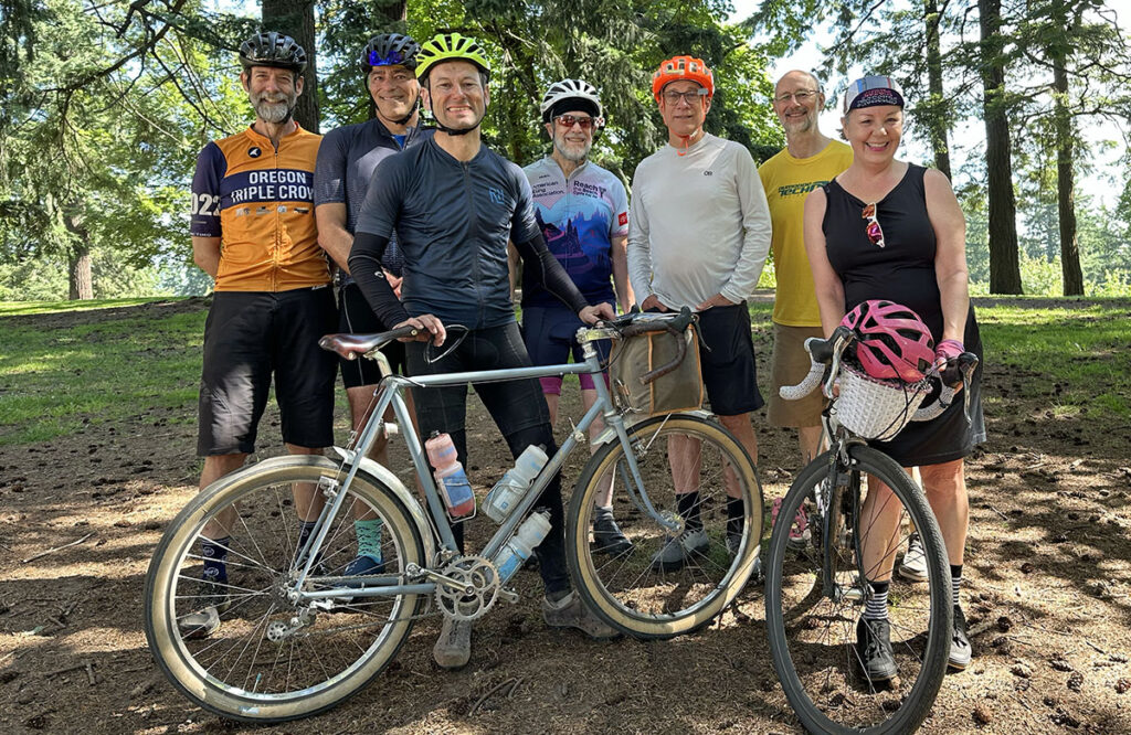
I reach Portland in the morning hours of Day 3. Ending the ride on Mount Tabor, overlooking the great city, is an inspired choice. I sprint up the hill, eager to beat 50 hours. I finish in 49:58 hours. To my surprise, I am welcomed by a group of cyclists who have followed my progress on the tracker.
It truly means a lot to me that so many riders, racers and bikepackers have come out to greet me. I feel a bit bad, though, as I am tired and exhausted, and probably not the most social. One of them, Mark, even escorts me to the train station. Another gives me a gift of a chocolate bar that tastes delicious during my train ride back to Seattle.
Without a doubt, the OCVA is the hardest ride I have done. Oregon Outback, Arkansas High Country, Unbound XL, even Paris-Brest-Paris just don’t compare, especially with respect to the mental challenge. The only route that comes close is the Dark Divide 300, also in the Cascade Mountains, but the OCVA is just that much longer, pushing me to the limit and beyond.
I usually share some statistics of the ride. This time, there were too many decisions to be made to keep track of calories and liquids consumed. Here’s the best I have:
- Distance (including detours, back-tracking due to missing bridge, etc.): ca. 423 miles (680 km)
- Elevation gain: 29,465 ft (8,980 m)
- Time: 49:58 hours
- Miles walked in snow: 11 (18 km)
- Time walked in snow: 6 hours
- Max. speed: 48.6 mph (78.2 km/h)
- Total number of stops: 6
- Mile 72: Crater Lake
- Mile 157: Oakridge
- Mile 224: McKenzie Crossing
- Mile 249: Clear Lake
- Mile 293: Detroit
- Mile 366: Estacada
- Total stop time: 2.5 hours
- Calories consumed: Lots
- Water and liquids consumed: Lots
The official route is here: https://ridewithgps.com/routes/30586660
Tracking of the FKT ride is here: https://trackleaders.com/ocva25f.php
