

Final Details: BQ Un-Meeting and Volcano High Pass Challenge
Volcano High Pass Challenge (Saturday, 9/2)
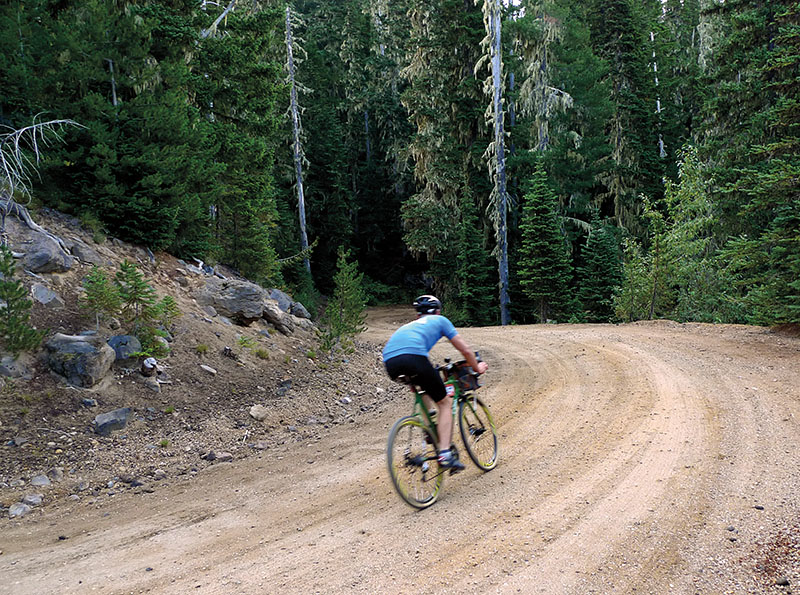
Part race, part scenic ride with friends, this unsanctioned event challenges riders of all abilities. The distance is 170 km (105 miles), with half on gravel and half on pavement, from Packwood, at the foot of Mount Rainier, to Carson, on the Columbia River.
Anyone is welcome: Just ride the course and have fun. For the one-day ride/race, show up at the start at 5 a.m. on Saturday, Sept. 2, in front of the Packwood Library. Whether you compete for the fastest time, ride with friends, or start early and complete the ride at a more relaxed pace over multiple days, it’ll be an unforgettable experience.
Riders will need to be self-sufficient as no services will be provided. Be sure to review the route and print a copy of the cue sheet (links below). A few pointers on the route:
- A third of the total climbing is during the first 25 km (16 miles). Don’t despair – it gets easier (and even more scenic) later.
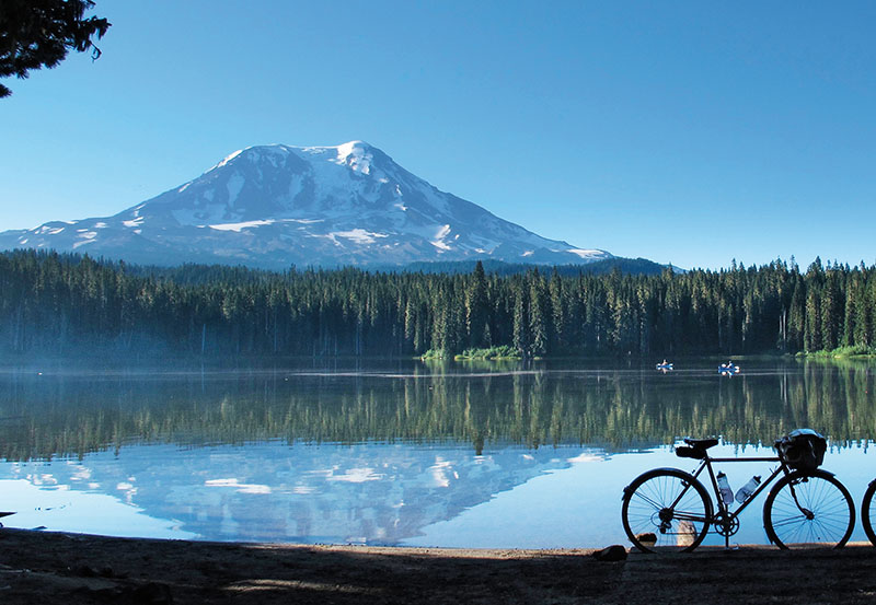
- The last climb to Walupt Lake is very steep, but short. Don’t be afraid to walk, if necessary. The view of the lake is worth it.
- There is no water between Walupt Lake (km 38 / mile 23) and Trout Lake (km 108 / mile 67). Plan accordingly. We will try to have water at Takhlakh Lake (km 66 / mile 41), but don’t count on it.
- Great blackberry shakes in Trout Lake at the restaurant/gas station. Don’t miss it.
- The last 30 km (20 miles) are downhill! Make sure your brakes work and enjoy!
BQ Un-Meeting (Sunday, 9/3)
Camping: We have a group tent site at the Wind River RV Park and Lodge in Carson for Saturday and Sunday nights. Cost is $15 per tent per night. In exchange for this reduced group rate, the campground asks for a single payment, so please give Theo cash before setting up your tent. There will be enough space for everybody who wants to camp.
On Sunday we’ll have two rides:
Weigle Hill
To Trout Lake on the Volcano High Pass route, then circling Weigle Hill and Buck Mountain on beautiful gravel roads. This route covers approximately 150 km (93 miles), almost all on gravel. Route details are subject to change.
Route on RWGPS
Cue Sheet

Calamity Peak
This is a mostly paved course (with a little light gravel in places) on one of the most amazing mountain roads in the Pacific Northwest. This is an out-and-back course, allowing you to shorten or extend the ride as you like. The distance is 70 – 90 km (43 – 56 miles), depending on where you turn around.
Route on RWGPS
Cue Sheet
Return from the Un-Meeting (Monday, 9/4)
Carson to Portland
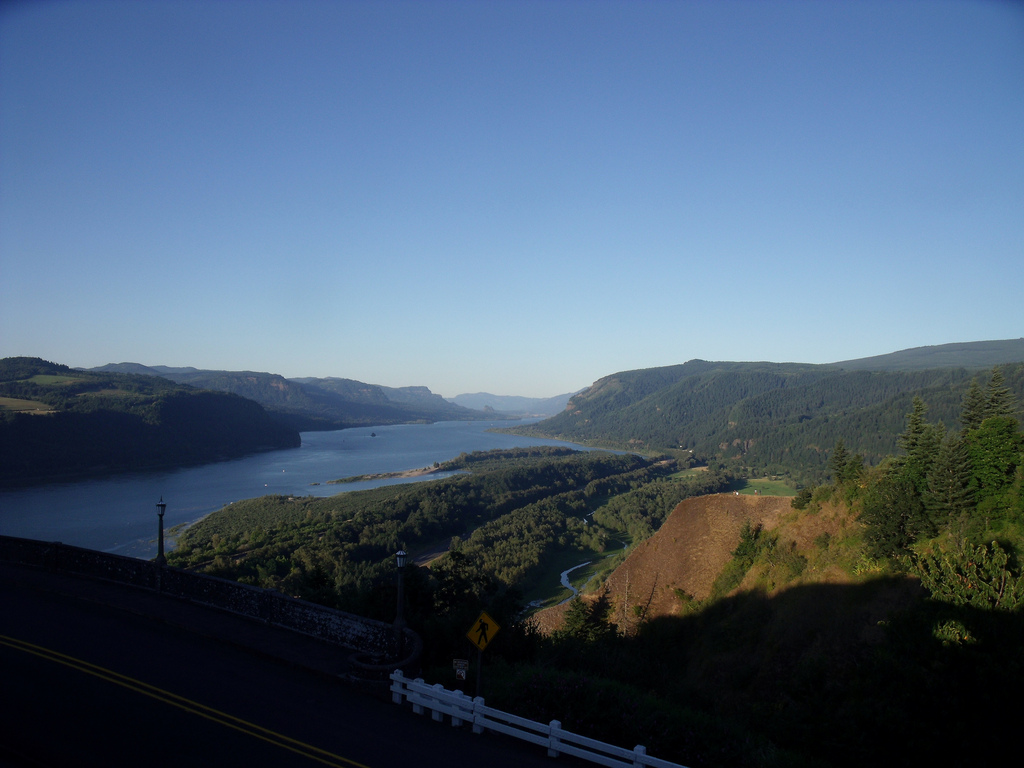
On Monday, after the Un-Meeting, many of us will ride to Portland via the Bridge of the Gods and Historic Highway 30 in the Columbia River Gorge. This is a wonderful scenic, paved route of about 100 km (62 miles). There are many waterfalls and viewpoints along the way. Bring $1 to pay the bicycle toll after crossing the Bridge of the Gods. There is a staircase about 19 km (12 miles) into the route where you will need to carry your bike.
Route on RWGPS
Cue
Photo credits: Theo Roffe (3, 4)
