

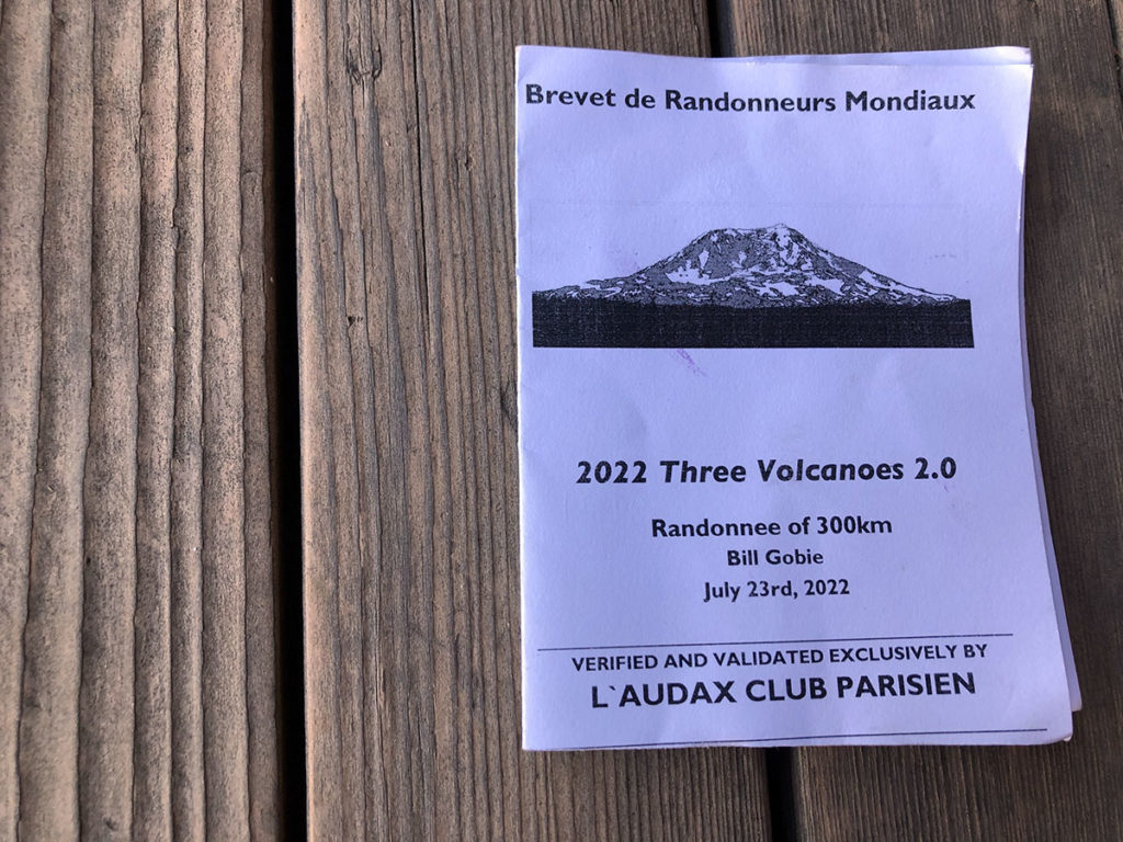
Randonneuring in the Grand Tradition: 3 Volcano 300 km
Since its inception more than a century ago, randonneuring has always been about pushing one’s boundaries, exploring distant places, and experiencing spectacular scenery, all while enjoying the company of other like-minded cyclists. That tradition was alive and well last weekend during the 3 Volcano 300 km brevet.
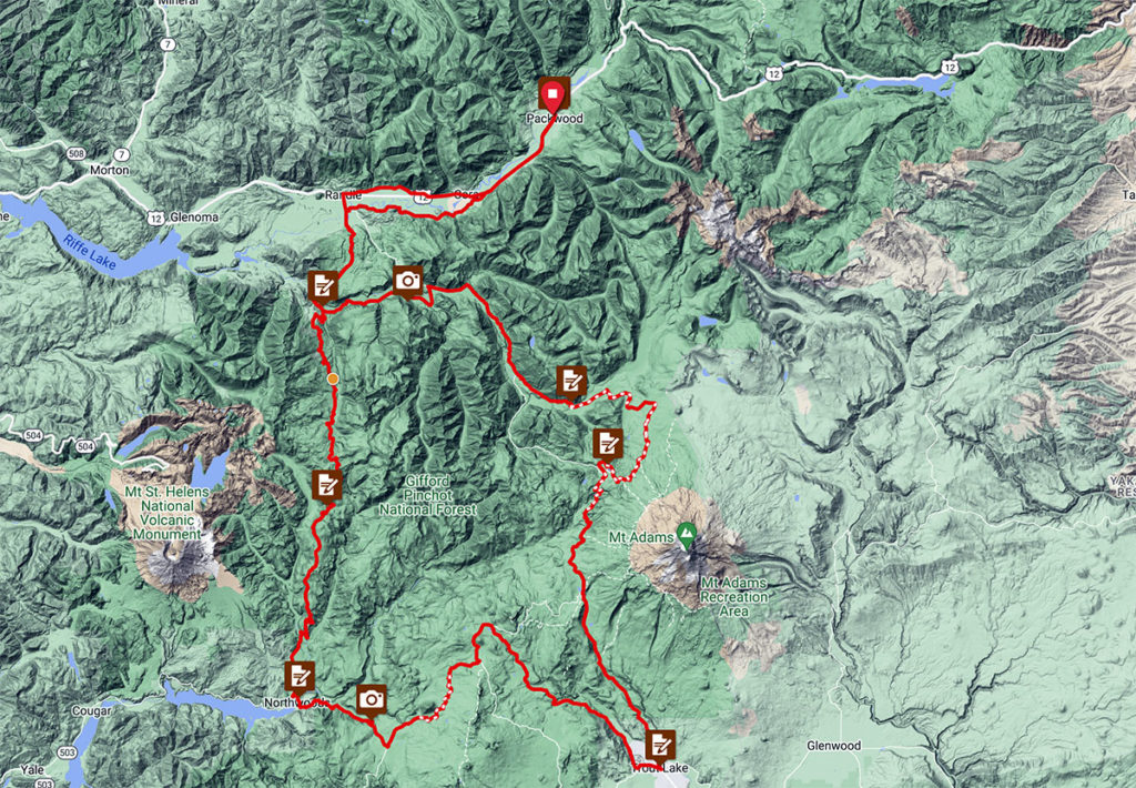
The course went right into the heart of the Cascade Mountains, into an area between the three big volcanoes Tahoma (Mount Rainier), Klickitat (Mount Adams) and Loowit (Mount Saint Helens) that’s also known as the Dark Divide. It’s remote—we passed only two stores in 250 km—and mountainous.
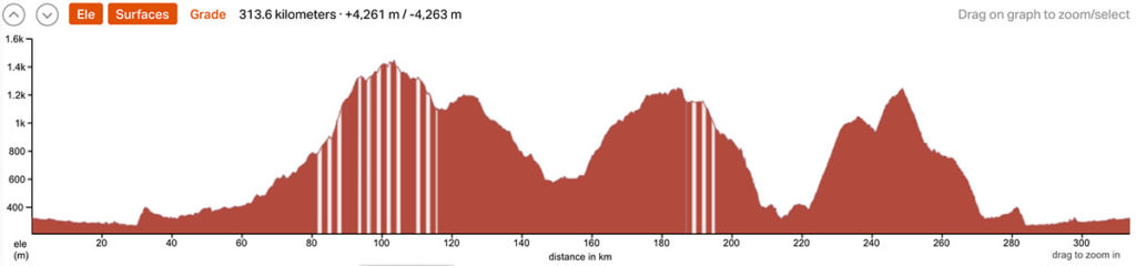
In fact, apart from the first and last kilometers, there’s hardly any flat stretch. The elevation gain translates to 14,000 ft over a 200-mile distance…
There’s gravel, too. (For once, the surface descriptions on RideWithGPS are actually accurate.) Going over some of my favorite roads and passes, I wasn’t going to miss this ride. Plus it was a great opportunity for a last test of the final production version of our new Nivex derailleur…
Bill Gobie, the organizer, had fine-tuned the route to include more gravel, more great scenery, and less traffic. (Gravel roads are fun when they are empty, but cars create dust clouds that are decidedly less fun.) Bill even charted a bail-out route that allowed riders to descend back to the start after experiencing the first half of the ride, if they had doubts about finishing. (There’s no cell service in most of the Dark Divide, so getting a ‘bail-out’ isn’t an option.) Bill set up two ‘staffed’ controls in places where many riders might need water, but that was the extent of the support. It felt like returning to the roots of randonneuring, when Velocio and his ‘School of Saint-Etienne’ explored the mountains of France on their bikes.
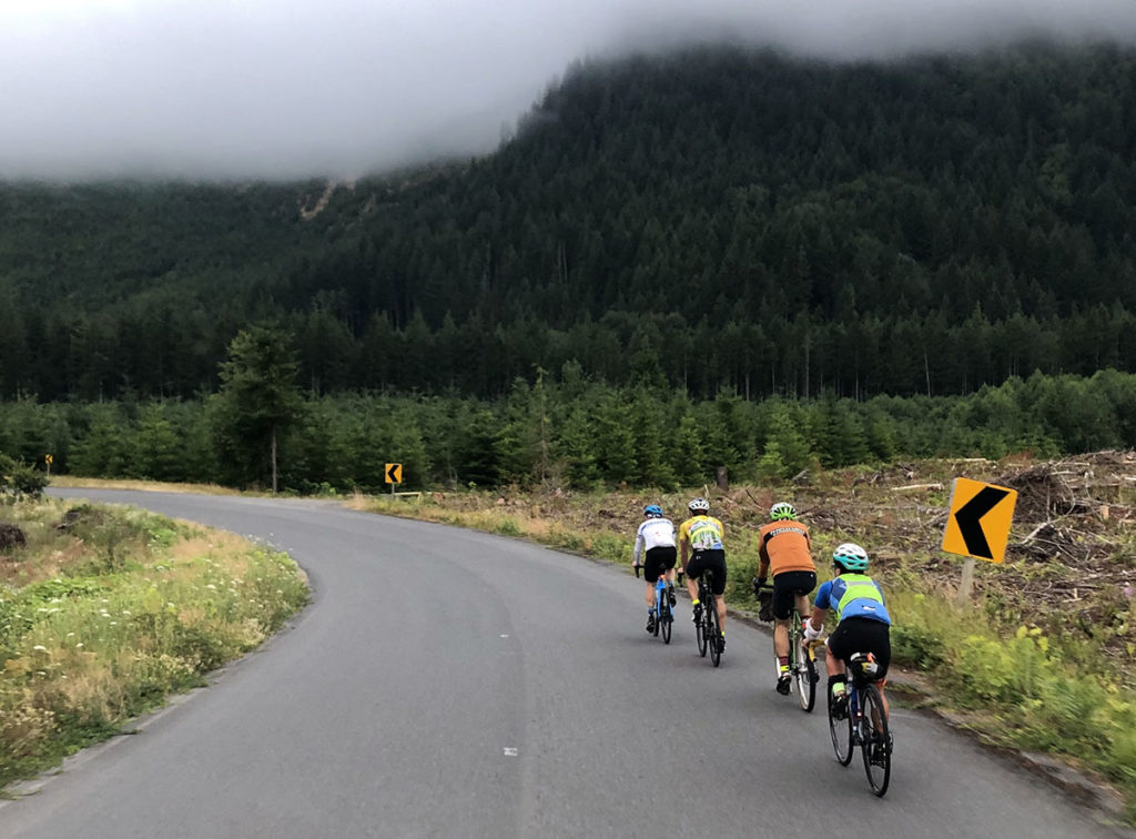
And so a couple of dozen randonneurs met in Packwood at 5 a.m. last Saturday. After a nice warm-up spinning for 45 minutes down the Cowlitz River Valley, the first hills split up the group. The sky was overcast, but we knew the sun would burn off the clouds—hopefully before the first of many vertiginous descent on this route.
Bill, the organizer, had informed riders that 32 mm tires were the minimum considered appropriate for this route, and wider was recommended. Looking over the bikes of the lead group, it was clear that this advice had been interpreted in two ways: Some were on the widest tires our bikes could fit. Most others ran 32 mm tires, figuring that they’d suffer a bit on the gravel in the hopes of extra speed on the pavement. After all, 88% of the ride was paved.
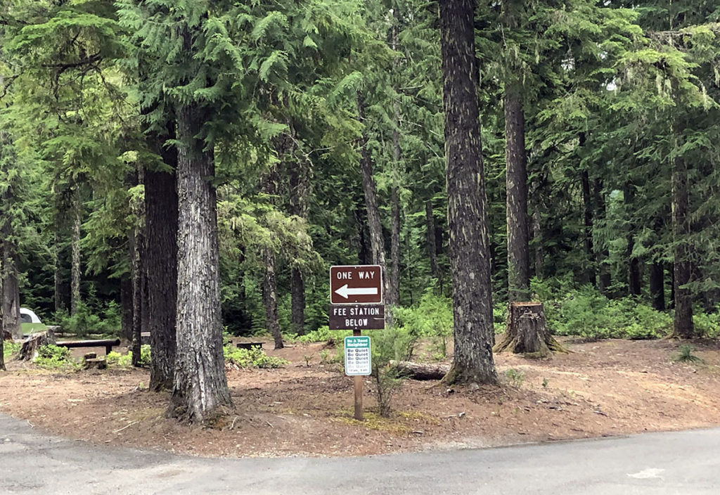
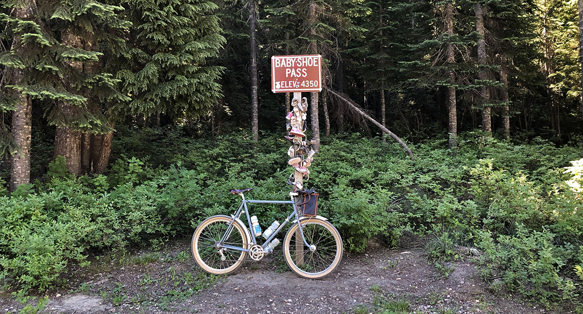
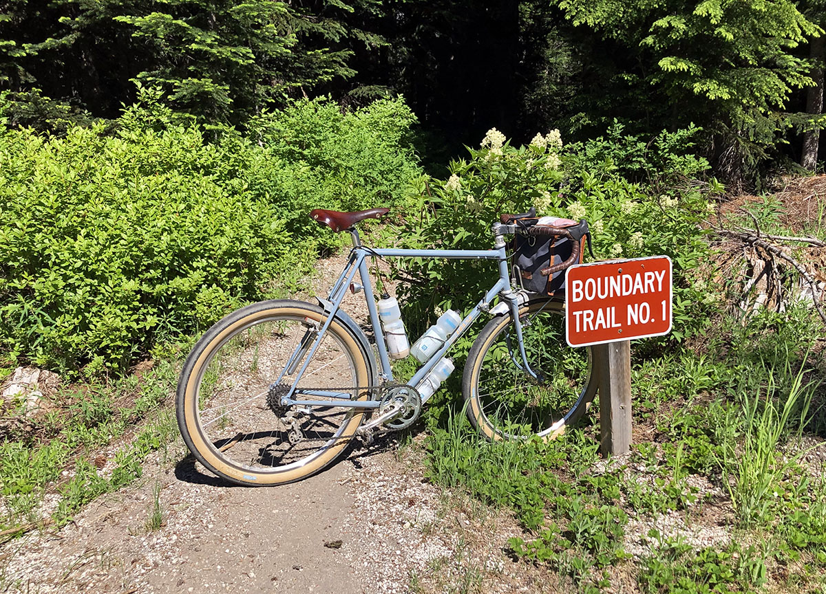
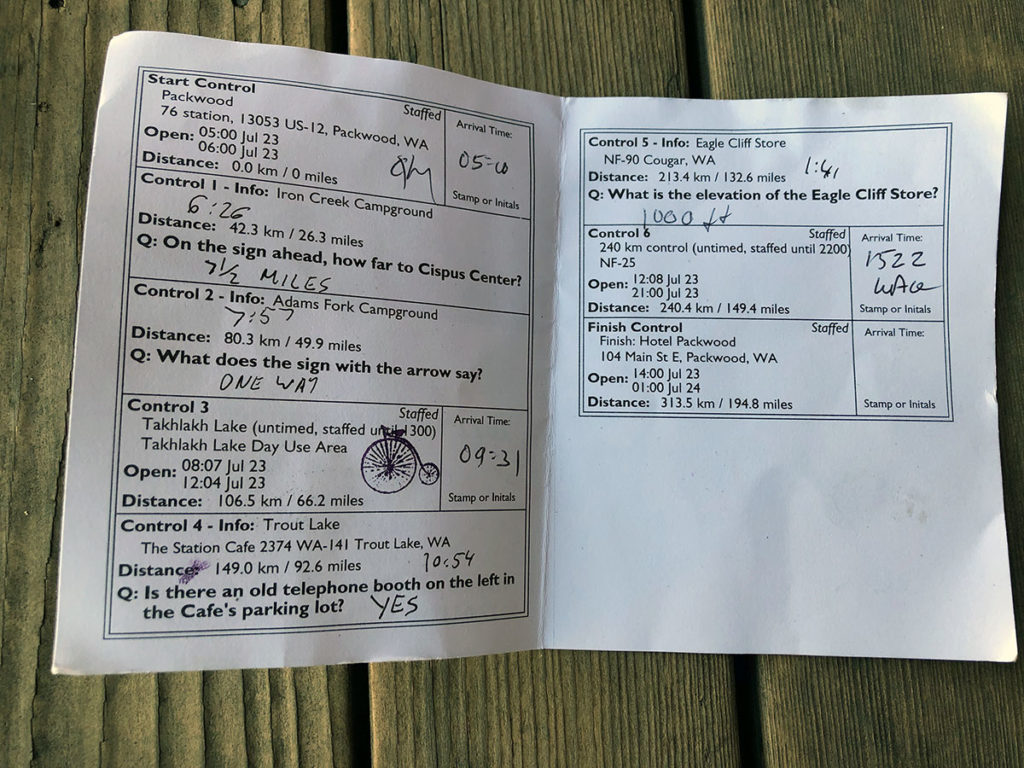
Randonneuring is a sport that pre-dates GPS tracks, and to show that you’ve completed a ride, you have your card signed at controls—usually businesses along the route. Except there’s nobody in the Dark Divide to sign your card, so there are ‘informational controls’ instead. You answer a question that proves that you’ve been here. (Some rides like the Super Randonnée 600s have you take a photo of your bike at specific locations instead.) At this deserted campground, the question was what the sign with the arrow said.
By this point, I was riding on my own. My bike climbed well on the paved section, and the others missed a turn. (Having my route sheet on the handlebar bag made it easy to anticipate turns, rather than rely on the GPS alone.)
After this control came the ‘new’ gravel section, and it was truly spectacular: a steep road winding up the flanks of Klickitat (Mount Adams) in tight switchbacks. The gravel was rough, but no problem on 54 mm tires. Then there was a stretch of paved road—nobody seems to know why a short stretch of road leading right up to the volcano was paved at some point. Perhaps for strategic military reasons during the cold war? That was a long time ago, and the road surface has become very rough, as the fine aggregate has washed away between the coarser stones. There’s so little traffic here that there are no potholes, thankfully.
The next stretch was a favorite, back on gravel: Forest Road 2329 skirts the flanks of the big mountain. It undulates without gaining or losing much elevation, so it allows carrying good speed. This road was more rutted than usual, but it was great fun nonetheless. Meeting the Pacific Crest Trail meant I had reached the high point of this ride at 1430 m (4700 ft).
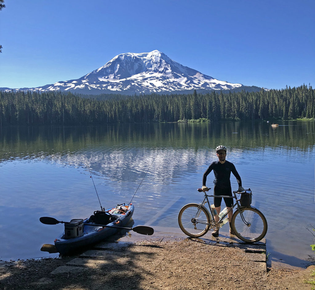
Takhlakh Lake was a ‘manned’ control. There is no public water here, and many riders probably needed to refill their bottles after 106 km (66 miles) on the road. The volunteers told me that the sun had just come out, offering a spectacular view of the volcano reflected in the lake. This brought back memories when Natsuko and I discovered the lake years ago and camped here on a tour from Seattle to Portland. Some very nice fellow campers lent us their canoe for an evening paddle on the lake…
No paddle (or swim) today—I was back on the road after a few minutes.
Another little stretch of pavement provided a welcome opportunity to eat some food and take off my arm warmers. The day was heating up fast.
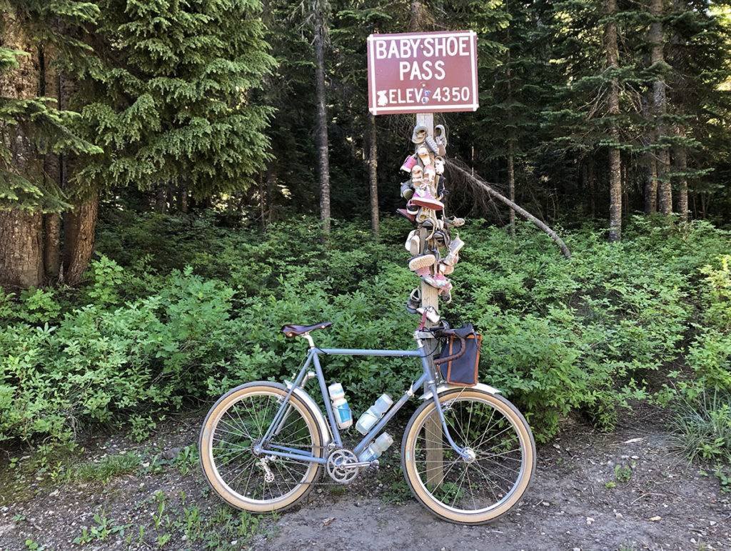
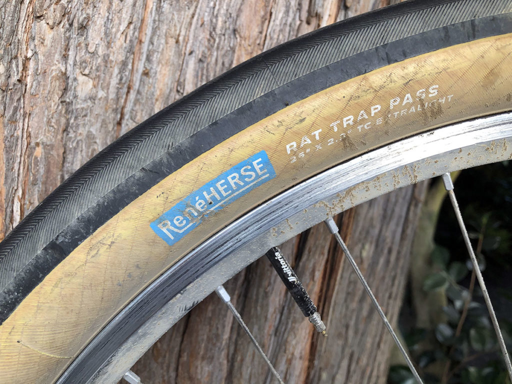
Descending toward Babyshoe Pass was fun. After rejoining Forest Road 23, there was a short climb up two switchbacks on (relatively smooth) gravel, and there was the iconic pass. The origins of the name seem to have been lost in the mists of time, but the custom of hanging kid’s shoes from the sign is alive and well. My friend Machiko later pointed out that I was riding the wrong tires—Rat Trap Pass 54 mm. The descent was as washboarded as usual, and I was glad for the 12 extra millimeters of width and 65% more air volume. What seemed like huge tires years ago is what we now ride on road rides…
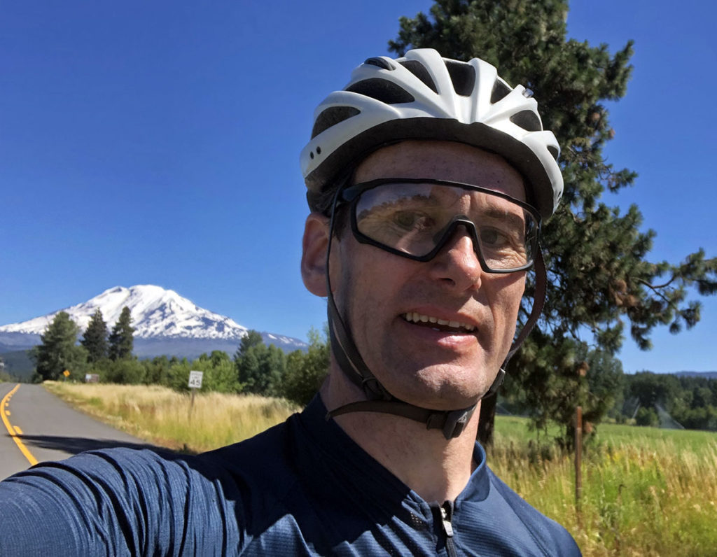
Spectacular views of Klickitat (Mount Adams) accompanied my descent—now on pavement—to Trout Lake. The last time I rode this course more than a decade ago, on a 1952 René Herse and 38 mm Mitsuboshi tires. That was the only bike back then that could tackle pavement and gravel equally well. My legs were stronger then, but the new bike (and tires) are better suited for this course. It’s nice to see that there has been progress after all!
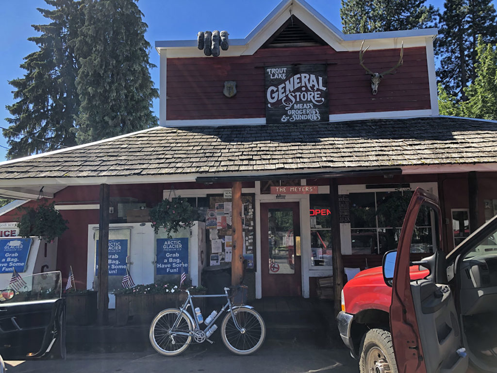
Trout Lake is famous for its outdoor cafe with huckleberry shakes made from local berries, but there was no time for that. A quick stop at the general store for water and a Pepsi, and I was back on the road.
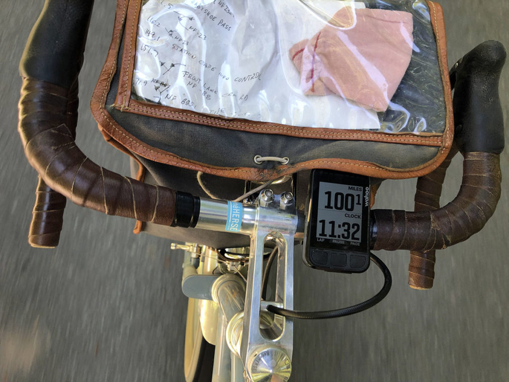
My GPS informed me that I had covered 100 miles in 6.5 hours exactly. It’s nice to see that the idea of a bike that can handle even rough gravel at road bike speeds is working in the Dark Divide as well. Shortly after this point, another rider, Clayton Pratt, caught up with me. On his narrow tires, he had lost 15 minutes on the way to Takhlakh Lake. “I rode my brakes all the way down the descents,” he told me. We rode together for a little bit, but he was clearly stronger today, so I told him to go ahead.
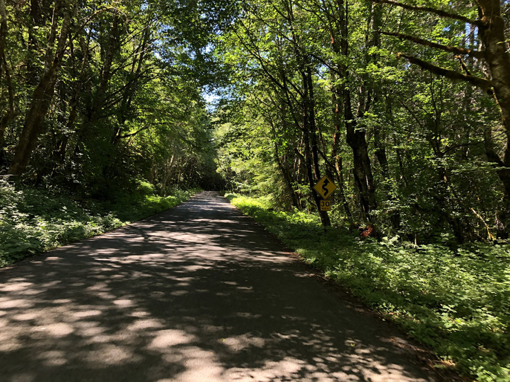
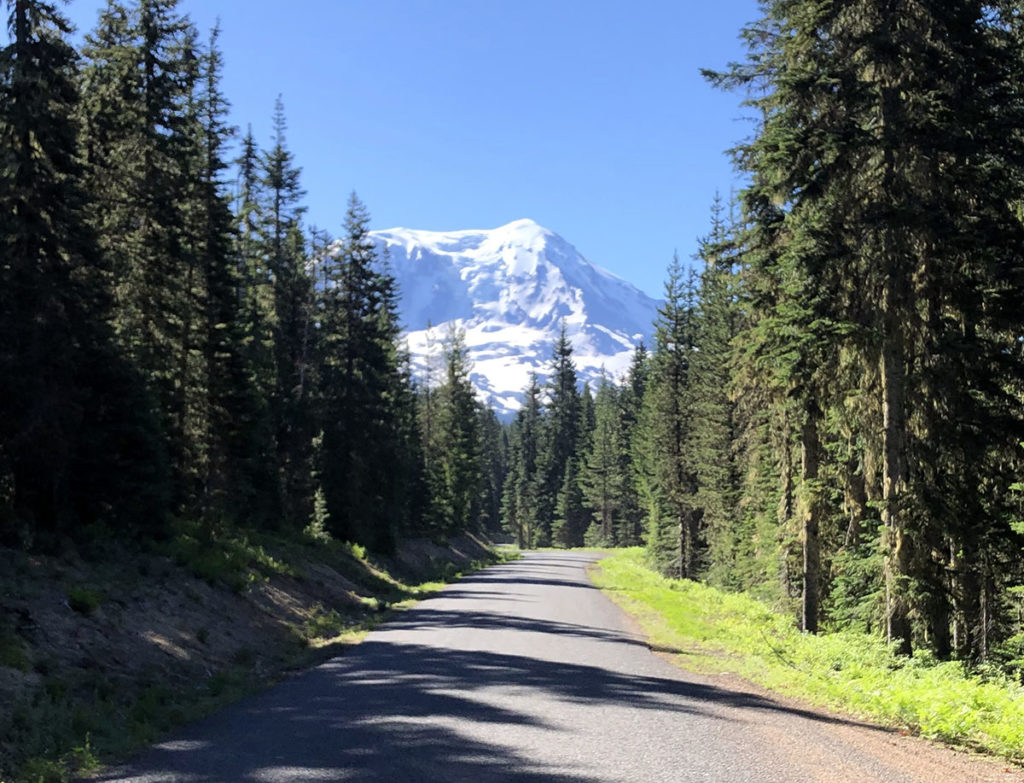
The second climb was long, and I was soft-pedaling a bit, knowing that needed to conserve energy for the last climb to Elk Pass. The descent was spectacular, with a beautiful komorebi pattern of light and shade on the road.
I caught up with Clayton again at the store in Northwoods. He had already eaten most of his sandwich, so we left together. (I ate on the bike, so there was less need to stop.) We chatted as we climbed the first, steepest part of Elk Pass, then he went ahead again. By the time he reached the control Bill Gobie had set up near the top of the climb, he was 15 minutes ahead of me!
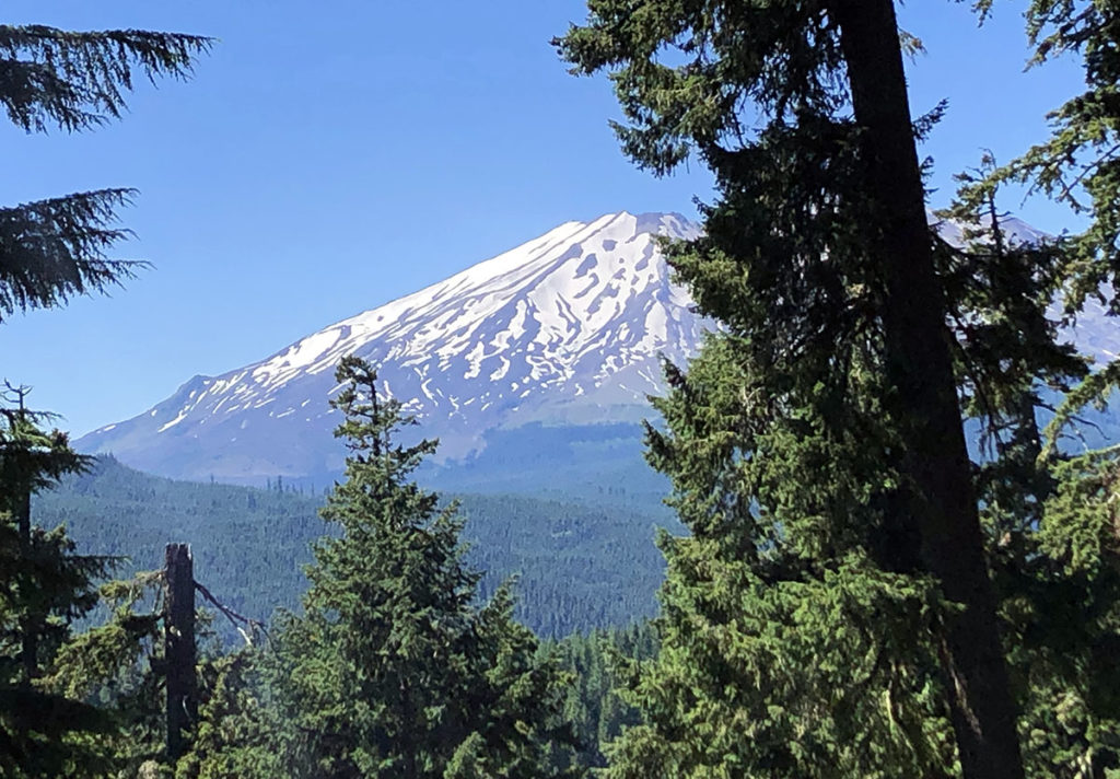
Elk Pass is a hard climb, rising more than 600 m in one go. Loowit (Mount St. Helens) peeking through the trees cheered me up a bit as I labored in the hot afternoon. Bill Gobie’s checkpoint on the false flat before the last push to the summit, and the few minutes of respite it offered were very welcome, as was the cold drink and the small boiled potato.
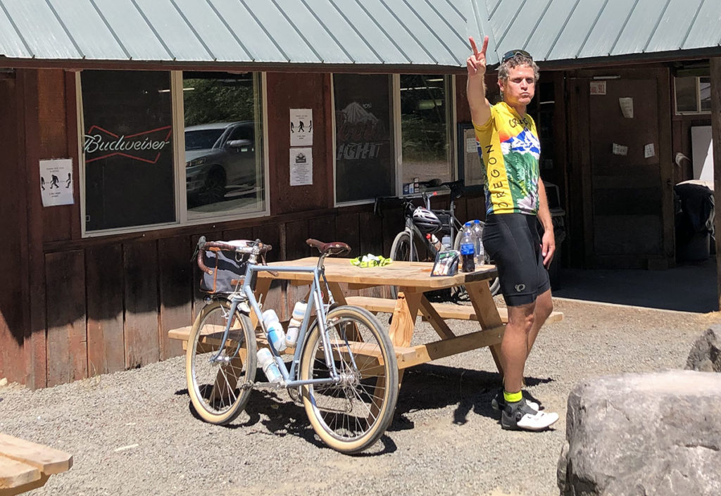
Much to my chagrin, there is no sign on Elk Pass, so all we get is this. But the descent makes up for it.
The descent from Elk Pass is one of the reasons I love cycling. It winds down the mountain in a succession of fast turns. It’s steep enough that it rarely requires pedaling, yet not so steep that you need to brake a lot. The road has settled in many places, so there are many dips and bumps. Strava later showed that I averaged 52 km/h (32 mph) on this stretch—including a few rollers that require pedaling. The descent took only seven minutes, but it felt much longer than that. And the memory will sustain me for a long time.
The ride into Packwood via Cline Road was another highlight. It winds along the river, with little rises and descents as it climbs the bluffs. It’s not steep—just right when you’re getting close to having all your forces spent. Looking at the time and distance, I realized that breaking 13 hours for this ride would be hard, but that wasn’t going to stop me from trying. A big tailwind made the last miles on the highway—the only boring part of this ride—pass quickly, and then I pulled up at the historic Hotel Packwood.
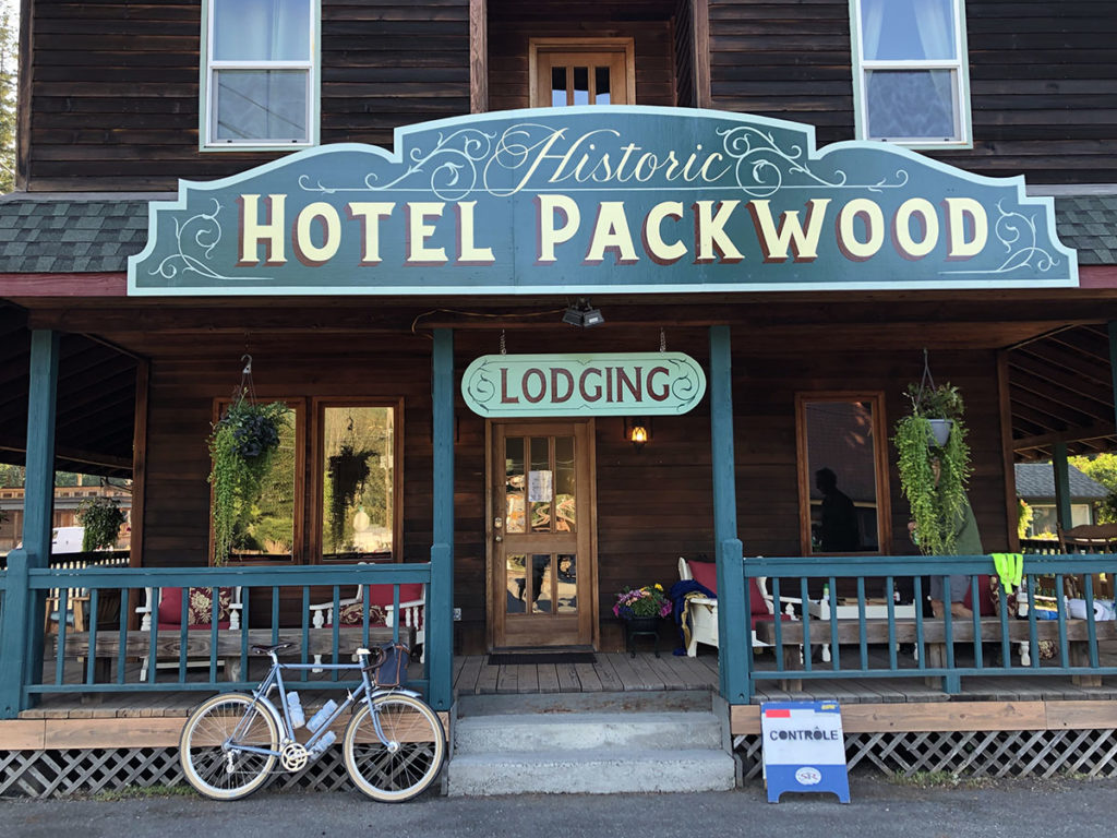
As much as I had enjoyed the ride, it was nice to be done. To sit down, take off my shoes, relax and chat with the wonderful volunteers and Clayton, the rider who came in ahead of me.
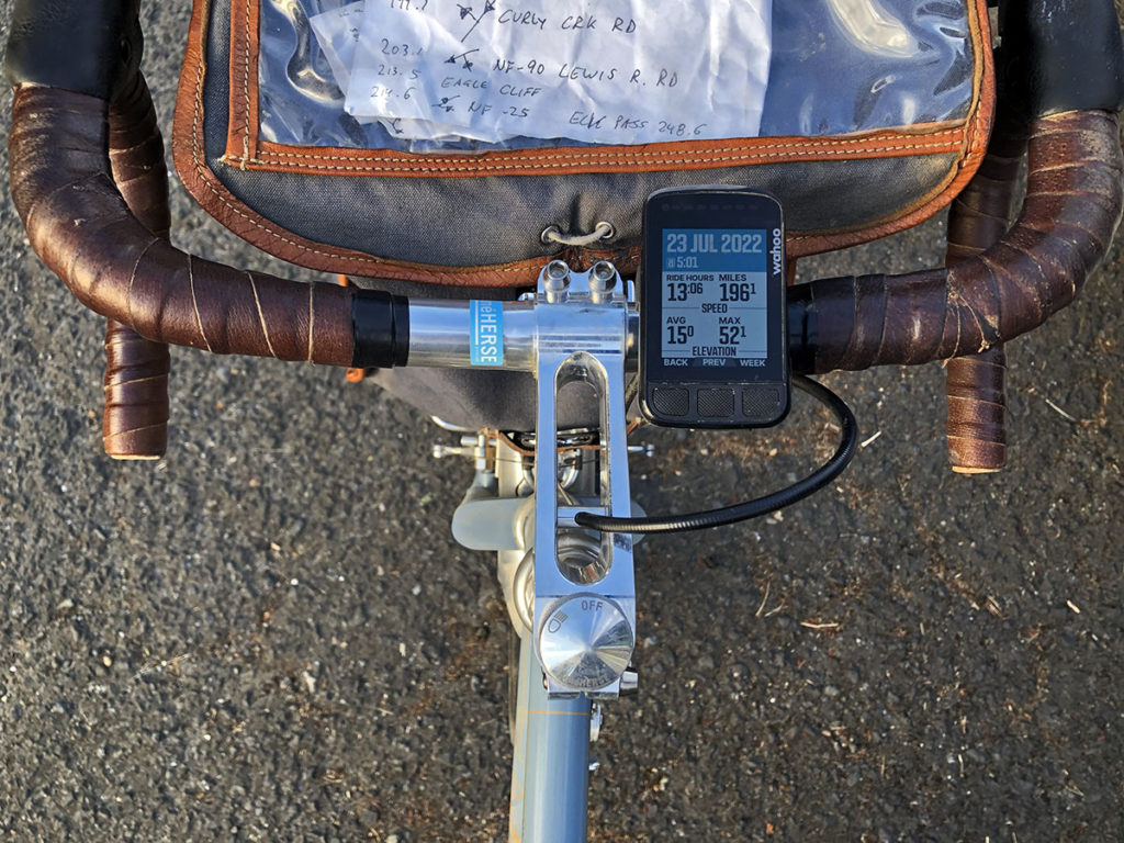
My final time was 13:06 hours. That works out to an average speed of 15.0 mph (24.1 km/h). (I set my GPS to miles for Unbound XL and haven’t switched it back yet.) I was surprised by the maximum speed—52.1 mph translates to 83.8 km/h. I’m not sure where I went that fast—probably on the descent toward Northwoods. In fact, I was deliberately holding back a bit, not wanting to take any risks. I guess that shows what a good bike can do on a twisty mountain descent.
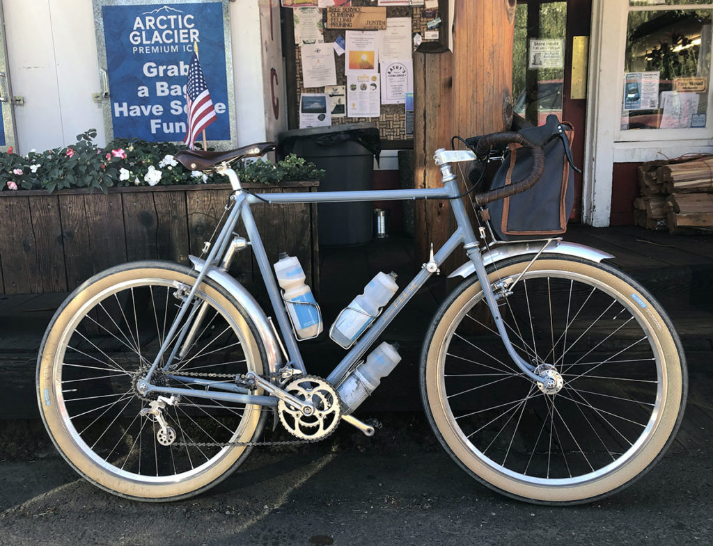
Speaking of the bike, I really love this machine. It’s pretty amazing what it can do. Paved or gravel, smooth or rough, it carries road bike speed and—just as important—the joyful feel of a road bike across all types of roads.
For this ride, I inflated the Rat Trap Pass tires to road pressure—1.6 bar (23 psi)—as I didn’t want to have to hold back on the twisty, paved descent from Elk Pass. It was the right choice, but it made the gravel descents a bit bumpier than ideal. In the future, I might experiment with starting the ride at 19 psi, then inflate the tires after the gravel sections. It’s probably not worth the effort, though.
The tires themselves are the same Extralights I used for the Oregon Outback and other rides since. They are covered in dust, but show little wear. They’re good for many more adventures.
Clayton and I compared our times as we chatted about the beautiful roads, challenging climbs and amazing views. He finished the ride 14 minutes ahead of me, with an excellent time of 12:52. He was clearly the stronger rider, but, rolling on 30 mm tires inflated to 4.8 bar (70 psi), he lost 15 minutes on the gravel section to Takhlakh Lake. He made up those 15 minutes in the next 80 km (50 miles). Then he pulled 15 minutes ahead on Elk Pass, but lost 1 minute on the descent and run to the finish. This suggests that our bikes rolled at the same speed on smooth pavement, but the big tires were faster on all other surfaces. Most of all, we both had a great time, and the hour or so we rode together was a lot of fun.
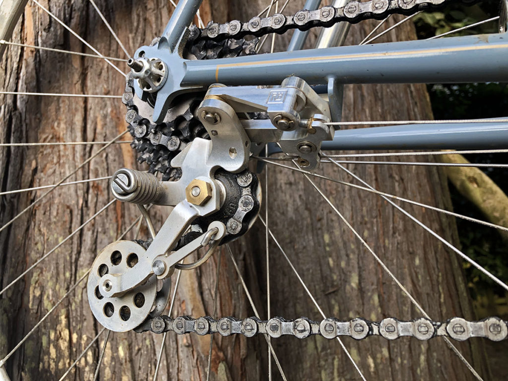
What about the Nivex? It performed flawlessly through hundreds (thousands?) of shifts on really rough roads. This is the final version, which has come a long way from the mid-century original. It’s hard to see how it could be improved any further. It’s exciting to see this project come to fruition. It’s for rides like these that we make Rene Herse tires and components—for the smiles they create while we’re on the road and the memories that we treasure long after the ride is over.
Further reading:
- The ride on Strava.
- Jan’s ride on the 1952 Rene Herse on the 3 Volcano 300.
(Back then, the course was bit shorter, with less climbing and less gravel, so the 11:49 time is not directly comparable to this year’s ride.) - Bill Gobie’s RideWithGPS file of the course.
