

Ted King discovers the Cascade Mountains
Ted King called: “I’ll be in Seattle in early August. Want to go for a ride?”
Of course I do – Ted is a lot of fun! But where do you take the King of Gravel for a ride? In August, the snow has melted even on the highest passes, so there are many options.
How about a loop from Packwood that skirts Mount Adams, traverses Babyshoe Pass to the remote hamlet of Trout Lake, then returns via Mount St. Helens and Elk Pass, with one of the best descents I’ve ridden anywhere? Well, that’s 200 miles – maybe a little ambitious for a one-day ride including a drive from Seattle and back. Laura and Ted had already explored the foothills east of Seattle the weekend before, so I wanted to give Ted a taste of summer riding in the Cascade Mountains.
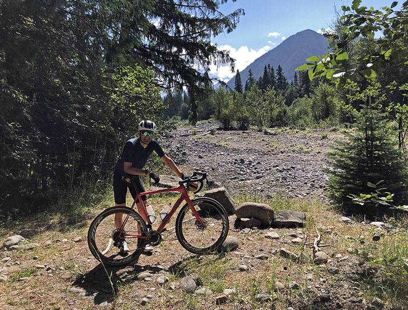
In the end, I settled on a route that combines great views with challenging riding – plus it included roads I’d never explored myself. It climbs the flanks of Mount Rainier, just outside the national park. And – a big plus – it’s only about an hour’s drive from Seattle.
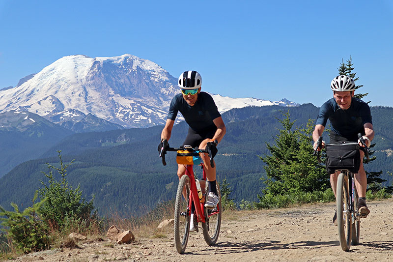
It’s always good to see Ted. He’s one of the most enthusiastic cyclists I know. After a short warm-up on single track along the White River, we crossed its milky waters (the river originates in a glacier on Mount Rainier just a few miles upvalley) and started climbing. Sun Top is an old fire lookout, and its supply road goes up for 7 miles and more than 3,000 feet. The average grade is 10%. It didn’t take long to rise above the valley, but the road just kept going uphill.
I quickly found out that there’s a difference between mere mortals and ex-professionals: Ted is really fast. He kept peppering me with questions about tire technology, bike geometry and other topics, while I tried to focus on spinning the pedals smoothly and breathing in the thin mountain air.
Finally I told Ted to go ahead and wait for me at the top. He did and took this shot of me climbing the last hairpin, with Mount Rainier in the background. While I was still working hard on the steep slope, he was already enjoying the view!
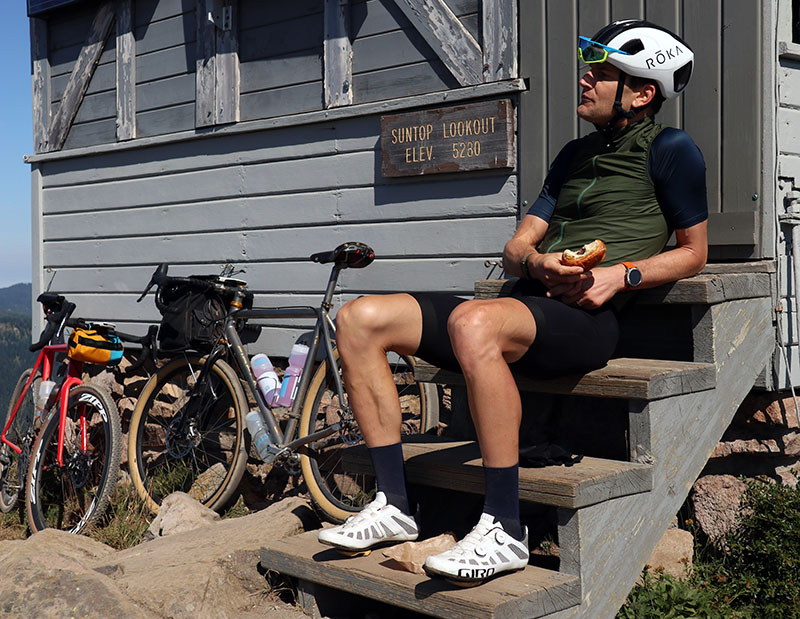
Of course, I have an excuse for my slower climbing: I carried chocolate croissants for our breakfast. It was a great spot for a break, with a splendid view and clear mountain air. There’s a reason why they chose this mountain for a fire lookout!
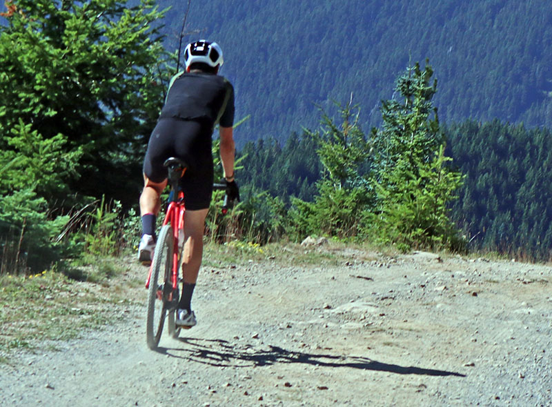
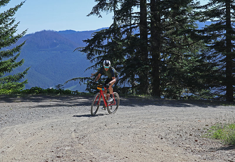
Then came the downhill. I managed to take one blurry photo, then I put the camera away. For this rough, washboarded descent, I needed both hands on the bars, and no bouncing camera on my back.
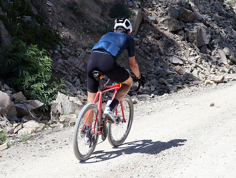
Ted’s Strava says that he’s ridden more than 8,500 miles this year, mostly on gravel. It shows in the speed he carries on the downhills. Strava says I hit 41.5 mph (65 km/h) on this downhill, and I believe it. I was just keeping up with Ted!
On the following climb, I was reminded that, to take photos, I need to be at least as strong as the rider I’m photographing, so I can pull out the camera and get my shots while pedaling. Not so with Ted. Most of my photos show a small blue dot disappearing around the next mountain ridge.
Not that Ted was racing. He seemed more interested in the landscape we were traversing than the speed we were making. He wanted to know who built these roads and why. (Many were built as logging roads, or to supply fire lookouts.) He was curious about the geology. (Mount Rainier is a volcano that is superimposed on the uplifted Cascade Mountains.) I remembered that he raced as a pro on an Italian team and enjoyed the cultural experience as much as the racing. Learning about what it’s like to live and race in Europe was fun, and Ted is a great storyteller.
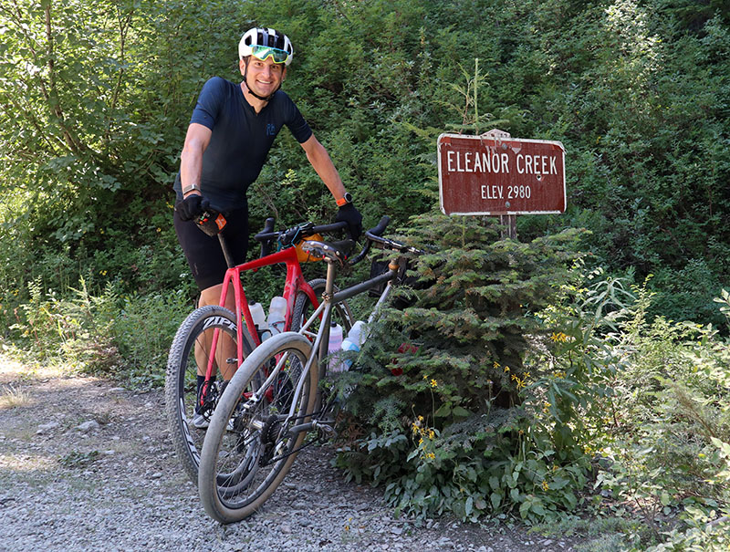
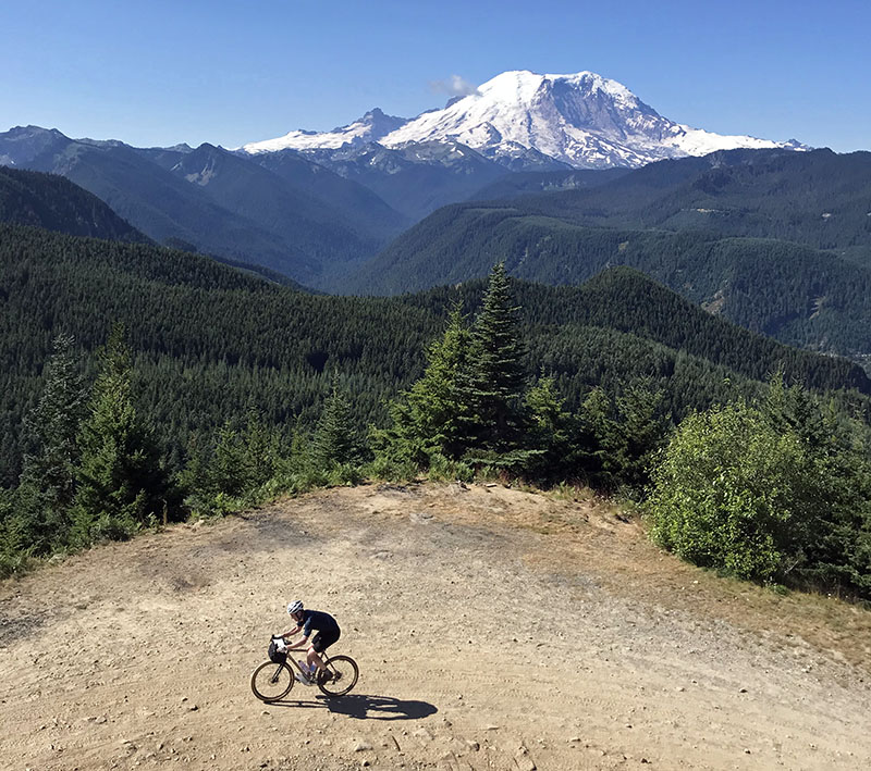
Near the top of the second climb, we filtered some water to refill our bottles from a creek that comes right out of Mount Rainier National Park. Ted remarked that the elevation sign couldn’t be right – we’d climbed more than that. I checked the topographical maps I had brought just in case. Indeed, we were at 4,365 feet. At first, I suspected that the road might cross Eleanor Creek again further downvalley, and somebody mixed up the signs. But the map shows that the creek is pretty short before it flows into Huckleberry Creek, which itself is a tributary of the White River. So there’s not real explanation for the error.
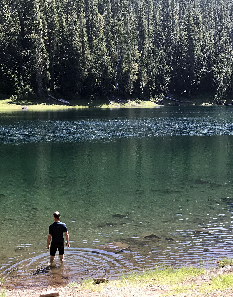
A vertiginous descent followed, then we took an out-and-back to the aptly named Lonesome Lake. After all the steep climbs and descents, it was great to be on more gently rolling terrain. It was getting hot by the time we reached the lake. The cool water felt great.
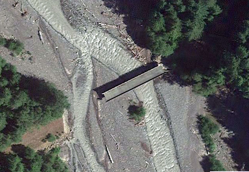
When I planned this ride, Google Maps suggested a road that crosses the West Fork of the White River and heads into the hills on the other side. When I checked satellite images, I saw that the bridge no longer was connected to the road, because the river had jumped its bed and created a side channel where the road used to be.
When Ted and I got to the location, there was no longer any trace of a bridge… Ted was surprised: The landscape in Vermont doesn’t change that quickly. Around here, we’ve learned the hard way that maps show roads that existed at one point, but don’t necessarily still exist today.
There was still a road on our side of the river. It used to be a paved logging mainline, but it was abandoned when the river cut it off. The pavement was still smooth where it poked through its cover of leaves and soil, but there were some pretty dramatic cracks and dips where the surface had settled and shifted.
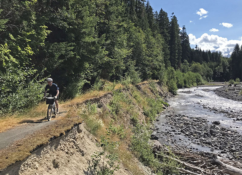
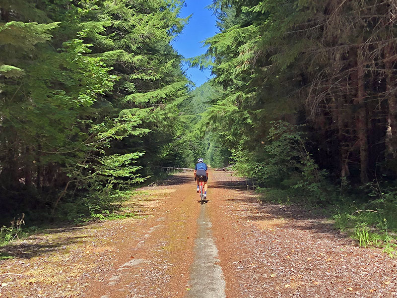
Slowly, river and forest are reclaiming the road.
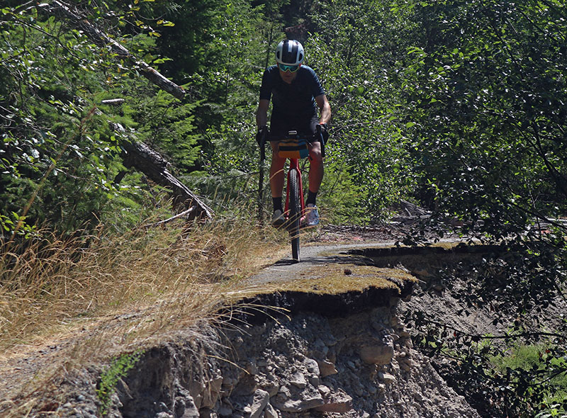
Ted commented: “I hope we can make it through. I wouldn’t want to climb back up the descent we just came down.” I was glad I wasn’t the only one feeling the effort in my legs. We needn’t have feared: The road remains passable – at least until the next winter flood.
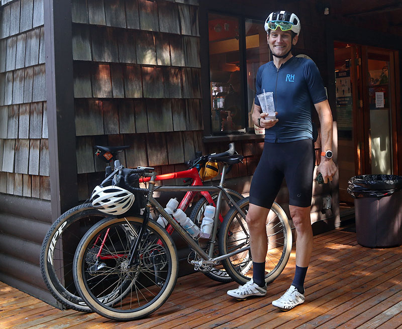
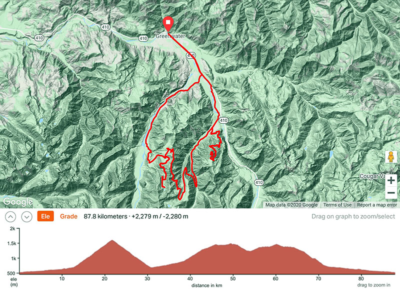
And then we were back in Greenwater. My favorite cafe was closed due to Covid, but another was open and served great blackberry shakes. A ride of 55 miles (88 km) at an average speed of just above 10 mph (16 km/h) doesn’t seem impressive compared to Ted’s usual accomplishments, but that’s the nature of riding in the Cascades. Somehow, Ted managed to set a few Strava KOMs along the way. Most of all, his sense of fun and adventure when we headed on unknown roads made this ride really special.
We would have loved to invite others on the ride, but social distancing is difficult with more than two riders. (We didn’t draft and mostly rode side-by-side, plus wore masks when we were closer than 6 feet.) Hopefully, life will have returned to normal when Ted’s in town next time, and we can do a ride with a larger group again.
Click here for a Strava profile of the ride that includes a route sheet.
Photo credits: Ted King (Images 4, 9, 13).
