A Long, Slow Winter Ride
Winter is a great time for riding in the Cascade Mountains. The high passes are covered in snow, but our favorite roads in the foothills spear far into the deep valleys of the mountains. These are long, cold, hilly rides. Rides that are about getting in a rhythm without stopping, about getting our bodies used again to the long hours in the saddle after some time off around the solstice. And yet on a recent ride, I couldn’t resist to snap some photos from the saddle, as the low winter sun illuminated the mountains covered in fresh snow. I got a late start from Seattle, but that didn’t detract from the joys of this ride.

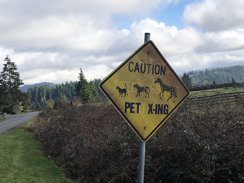
On these solo rides, even familiar courses look new. On this day, I noticed all the road signs. I smiled at this ‘re-purposed’ sign – I still recall when it was just a faded ‘Steep Grade Next 2 Miles’ road sign. There’s not need for a sign to warn of the grade – you see it when you reach it, and it’s one of the most fun, challenging descents on this ride.

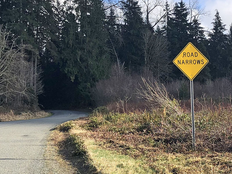
This sign needs no explanation… and it’s not like Old Pipeline Road (named after the huge wooden pipe that used to carry water from the mountains to Seattle) is excessively wide to begin with!

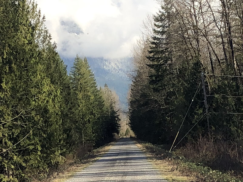
Even though this course heads toward Stevens Pass, I rode less than a mile on the highway. Over the years, we’ve scouted a network of roads that go through the hills, parallel the highway, or even follow a levee, such as this connection between Startup and Gold Bar.

I don’t think I’ll ever tire of riding on Reiter Road. It never disappoints…

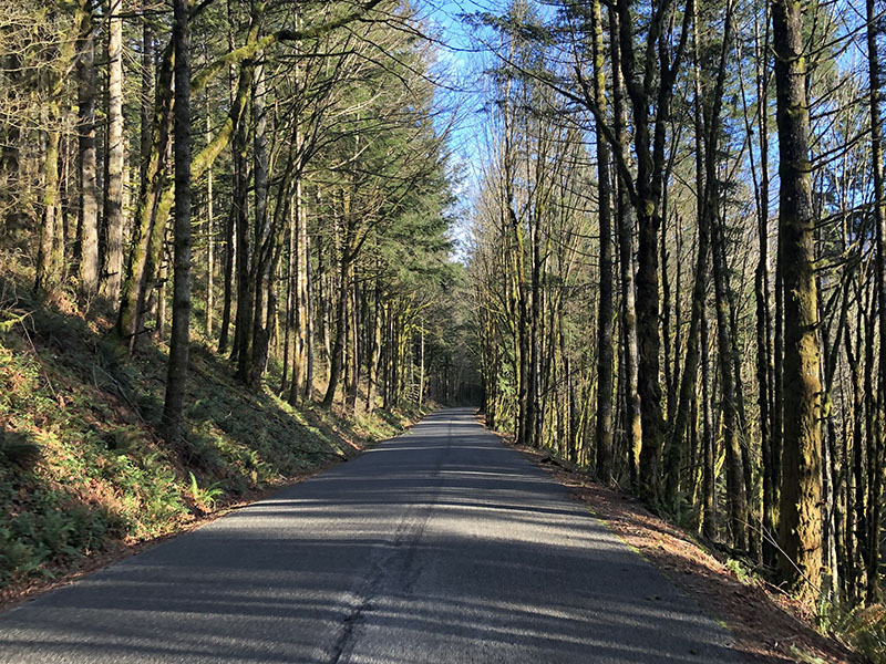
…especially when the sun comes out and paints the asphalt in a Komorebi pattern of light and shade. (Only the Japanese seem to have a special word for ‘light filtering through trees.’)

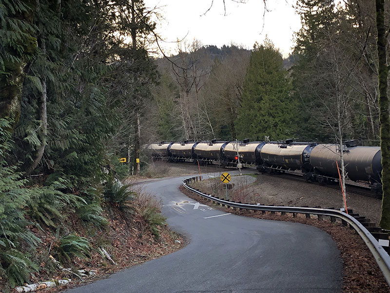
When I traversed the mainline to Chicago, a 100-car freight train rumbled by. As the air horns of the locomotives echoed across the valley, I realized that I’d been passed by more train cars than automobiles in the 70 miles (110 km) I’d ridden so far.

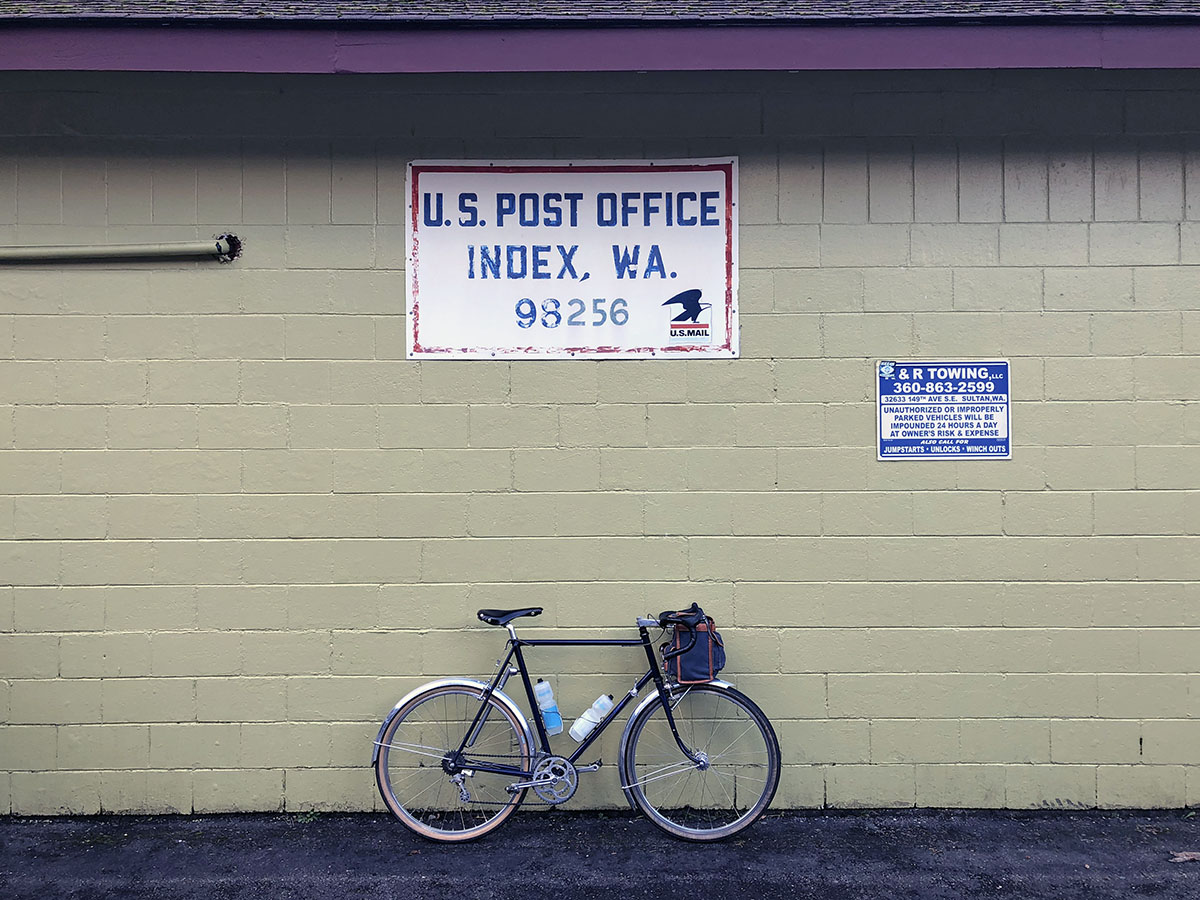
Index was my destination on this day. It’s a cute town deep in the mountains.

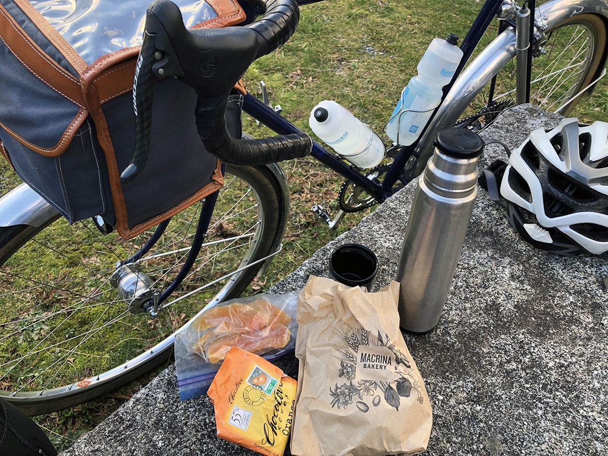
I ate the picnic I’d carried in my handlebar bag outside the old town hall…

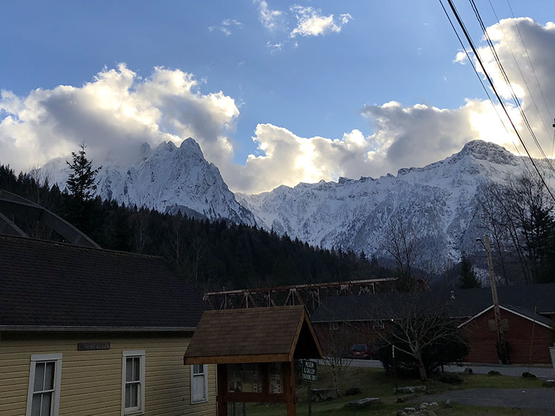
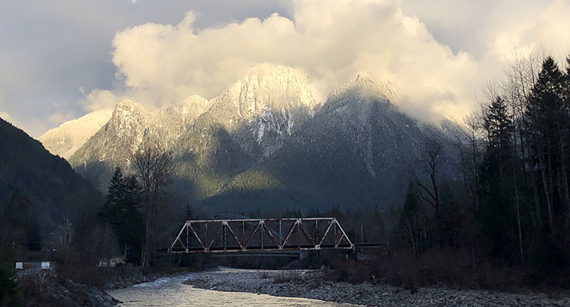
…as the sun set over the snow-covered peaks. On the way out of town, I said ‘Hi’ to a photographer who was waiting for the perfect moment to capture the old railroad bridge. I turned around and took the photo at the top of this post as I rode past him. Just at that moment, I heard the click of his shutter. It’s nice to think that we both have the same photo – and memory.

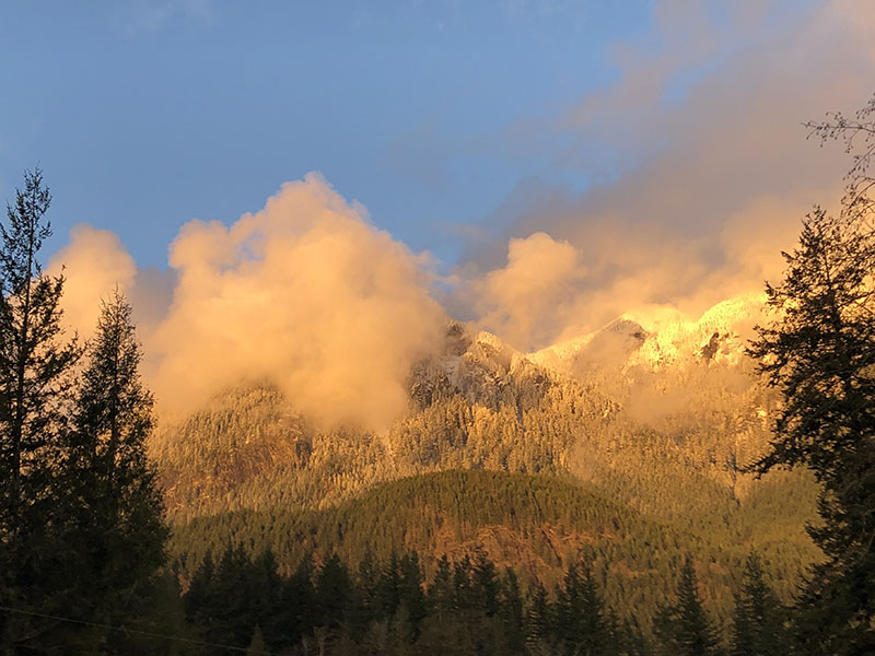
On the way home, I was treated to a second gorgeous sunset as I climbed the hills. Then I turned on my lights and headed back toward the city on small country roads, before arriving home in time for a late dinner. It was a day well spent!
Comments (24)
Beautiful pictures Jan. Makes me miss those big mountains in the Cascades. I like your food selections too, especially the chocolate! Gotta have chocolate on those long, cold rides 🙂
When you get the chance to go back Max, make sure I get an invitation 🙂
can you post the RideWithGPS data for this ride? Fantastic photos!
I don’t have GPS data, but it’s on Strava: https://www.strava.com/activities/4766148236/segments/2794632848974772086
What a gorgeous collection of roads. One feels so completed engaged on a bicycle on roads like these. I have very distinct memories of roads like these ridden over 40 years ago. Thanks to Jan for reminding us of the transcendent nature of this kind of cycling.
Beautiful phots and description – Inspiring !
This has me all nostalgic for the country roads that I used to ride in the pastoral hills of western New Jersey. Thinking of the light filtering through the trees on those tunneled single lane roads invokes a special feeling. Love the words and photos, Jan.
Love rides like these Jan! Thanks for sharing in words and pictures.
One question: do you know of anyone making a thermos for hot drinks that fits a standard cage without rattling or being the cage?…maybe with a one handed flip top?
Hot Chocolate makes for more smiles per miles.
I haven’t found one. I think the solution is to make a custom bottle cage that fits an existing thermos – bottle cages being easier to make than thermos…
There’s always the adjustable Arundel Looney Bin Cage…
It’s a tight fit but my iris style king cage fits my 20oz hydroflask with its twisting sippy lid. Or you could get one of those snack type stem bags like the roadrunner co-pilot so you can drink your cocoa when you’re upright and slow and hot drinks are nice, no reaching down required.
I regularly use the 20oz hydro flask with flip top in a King Cage on my single bike in the winter. We also use it year round on the tandem for coffee in the morning and cold drinks in the afternoon during brevets and other long rides.
When we kept cold coke in it (for bonk emergencies and/or celebrating another Col) during our Raid Pyrénéen Touriste on the tandem before PBP 2019, occasionally the top would pop due to pressure while climbing (if we didn’t let the coke go flat enough before sealing the lid)! It’s easy to reach down and close it if that happens and other than that specific issue it has been perfect for our needs.
I use a Kleen Kanteen insulated water bottle (stainless steel) for coffee in the winter and it works great.
Your photos showed that any day on the bike is a good day. I’ll check out the Strava link.
Good to see you here, Jeff. It’s been a few years, but you may remember we rode together in the first Cannonball I did.
Wow! Absolutely love the ’bridge’ image! Has some of the qualities of Ryu’s Photo on Flickr. They’re worth an excursion, too. https://www.flickr.com/photos/132035509@N08/
Some photographers have great skill. For me, it’s more about luck…
Very nice!
I didn’t know about Levee Road – I have never liked that nasty bridge on the highway. How did you get across the tracks? I don’t see anywhere obvious on the satellite or street views.
Ah, that’s a bit of a secret. You ride to the first signal post at the railyard, look both ways, and then cross the tracks. There’s a deer trail on the other side that takes you to the main road. After half a mile, you turn off that…
On the way back, I usually don’t bother and take the highway – it’s downhill.
I lived in Japan for 2 years when I was young and love some of the visual language but to stick up for the English language I think the term ‘dappled’ is pretty close to the same meaning. Love reading your blogs almost as much as the tyres. Cheers, Stephen.
“Dappled” is exactly it, and such a lovely word.
‘Dappled’ is a great word. It still requires the addition of ‘in sunshine’ to make it clear, unlike the Japanese ‘Komorebi’ which means ‘dappled in sunshine.’
Another (longer, and more climbing) route from Sultan to Startup uses the gravel “emergency evacuation” trail from Sultan HS up to Sultan Basin Road, and then Kellog Lake Road to Startup. The descent into Startup is a plus. No tucking required.
I’ve ridden that once, many years ago. It’s a big climb!
Comments are closed.