

A Winter Ride
When the forecast predicted a rare break in Seattle’s relentless rain, Ryan Hamilton and I quickly decided: “Let’s head to Index!” It’s a favorite winter ride that spears deep into the Cascade Mountains, but stays in the valleys (mostly), so it remains rideable while the high passes are covered with snow.
This time, we added a challenge: “Let’s try to get back before dark!” We knew this was ambitious for a 150-mile (240 km) ride with more than 6,000 ft (1,830 m) of elevation gain. Winter days in the Pacific Northwest aren’t exactly long, and we didn’t want to leave too early in case there was ice on the roads. We met at 7, just before dawn, and rode out of Seattle at a good clip.
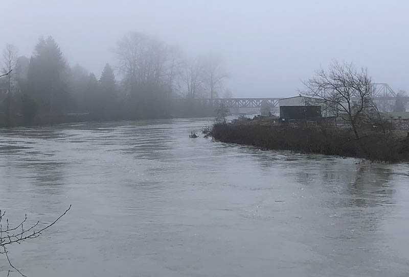
When we reached Snohomish, we saw the result of all the rain: The Skykomish River was close to overflowing its banks. Instead of our usual cafe stop, we loaded up with pastries that we stuffed into our handlebar bags. We ate them as we rolled into the Cascade foothills.
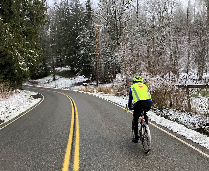
There had been some snow flurries in the overnight forecast, but we were still surprised to see so much of the white stuff by the roadside…
… and soon on the road, too.
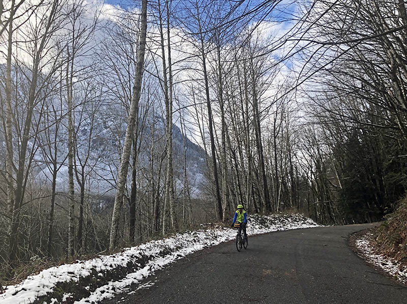
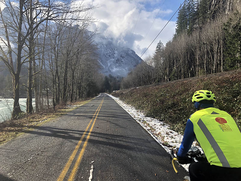
‘Flat’ is relative in the Cascade Mountains, and we were feeling the effort in our legs as we speared deeper and deeper into the mountains. The sun came out, and we enjoyed seeing the snow-covered peaks up close.
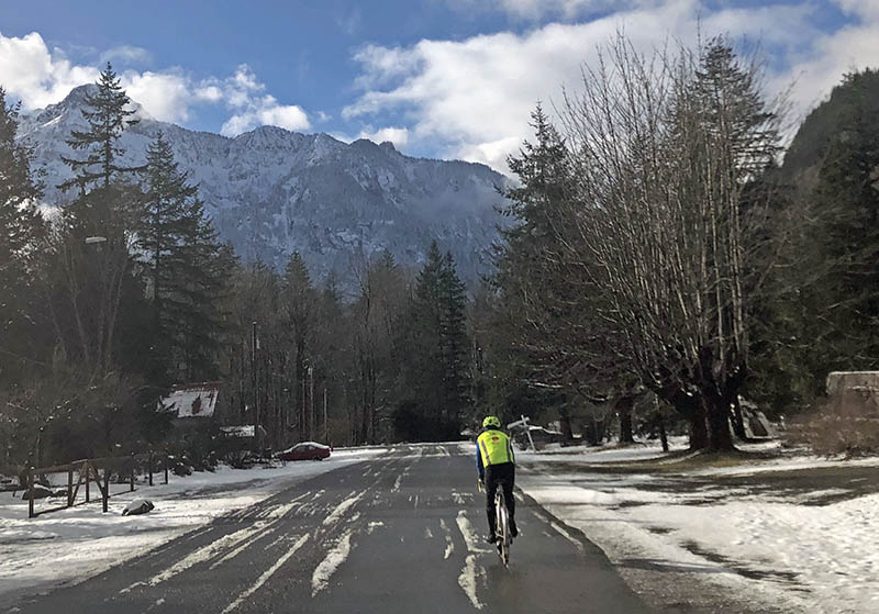
Just before one o’clock, we rolled into Index. Five hours for 80 miles (130 km): We were on target. Another quick resupply stop at the local store, and we headed back.
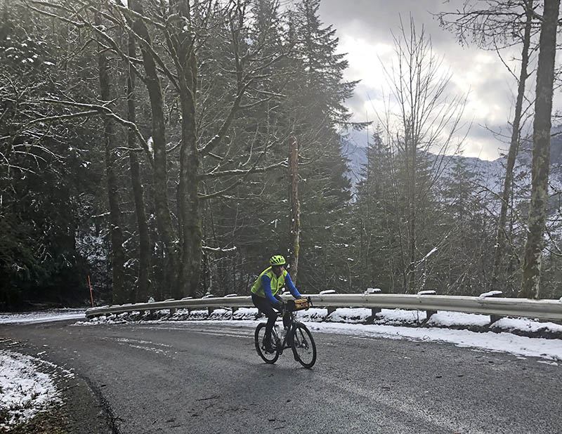
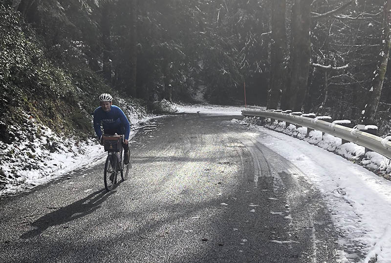
“It’s all downhill to Seattle,” I had joked as we left Index. Of course, it isn’t – but when the climbs are as beautiful as Reiter Road, they are fun even with tired legs.
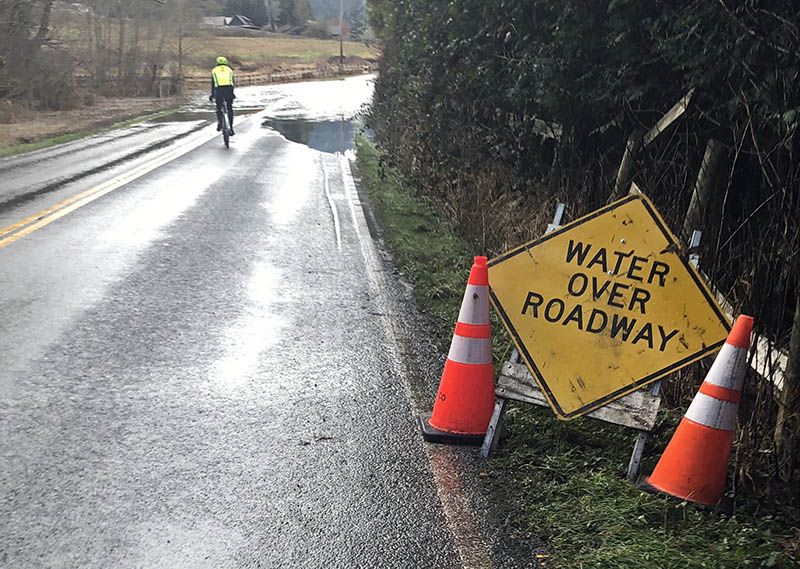
We took a different route back, and as we approached Monroe, we saw the first water on the road. We were glad to have fenders…
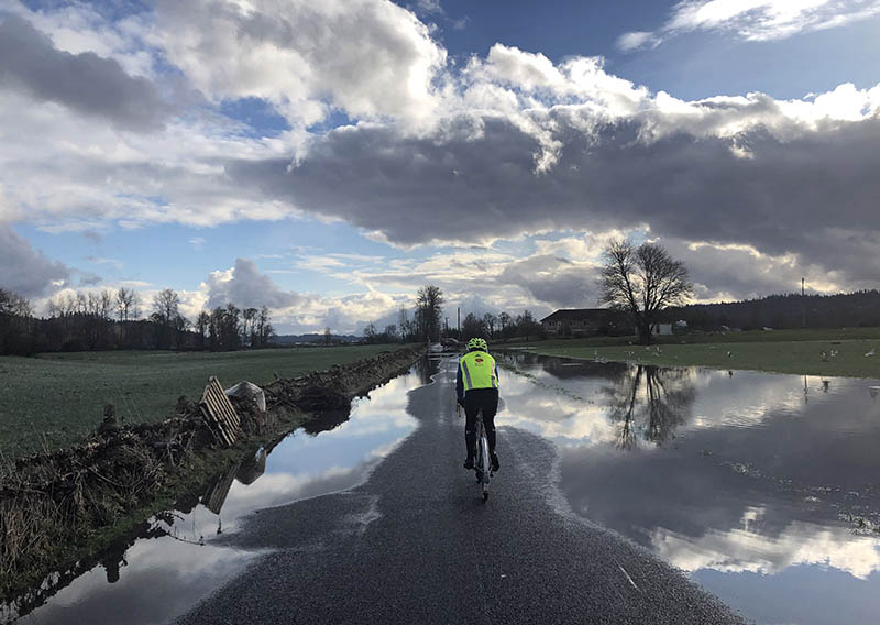
We rode on the narrow dry crown of the road…
…that got narrower and narrower.
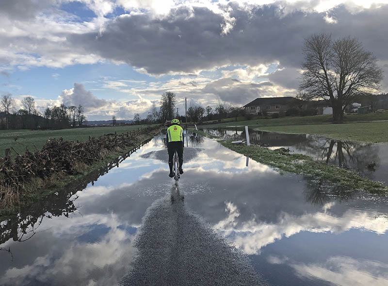
We forded some deeper sections, but we were hopeful that we’d make it across the Snoqualmie River valley. After that, we’d be in the hills again, well above the floodline.
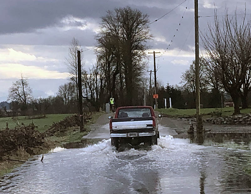
And then, with the appropriately named High Bridge in sight, we had to surrender. The water was at least 4 feet (1.2 m) deep. What to do?
A truck from the Snohomish County Public Works Department was parked at the edge of the water. “The roads upstream are flooded, too. You could go to Snohomish and take Fales Road from there. Except the road to Snohomish is flooded, too, so you’d have to detour through the hills to the North. Or how about taking the highway?” the driver suggested. We suddenly remembered that the big road runs on a high bridge across the valley. It’s not part of our mental map…
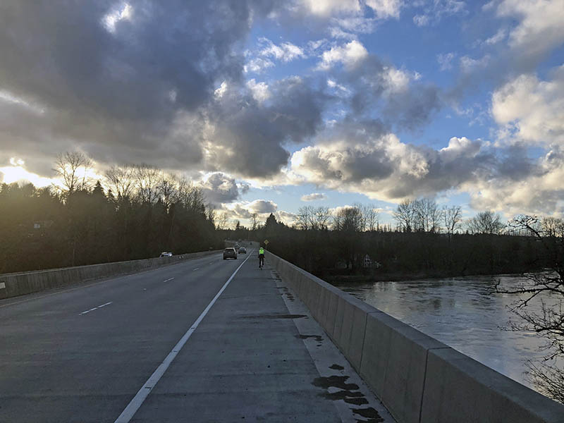
It wasn’t too bad, with a freshly swept shoulder and most traffic coming from Seattle as we were heading in the other direction, but it reminded us why we love the small roads so much. Once across the river, we turned off the wide ribbon of concrete and took to the backroads again. We didn’t make our goal, returning an hour after sunset. We’ll say that we lost some time due to the flooding, but it would have been close even if we had made it to High Bridge Road.
And rather than leave you with this shot of a highway, enjoy the little video clip of our ride. Hope you get out this weekend, too!
