

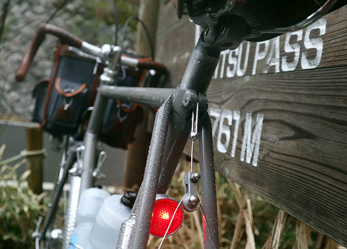
Yabitsu Pass in the Rain
During my recent trip to Japan, I found myself with a free day in Tokyo. With no time to plan, I decided to head to Yabitsu Pass.
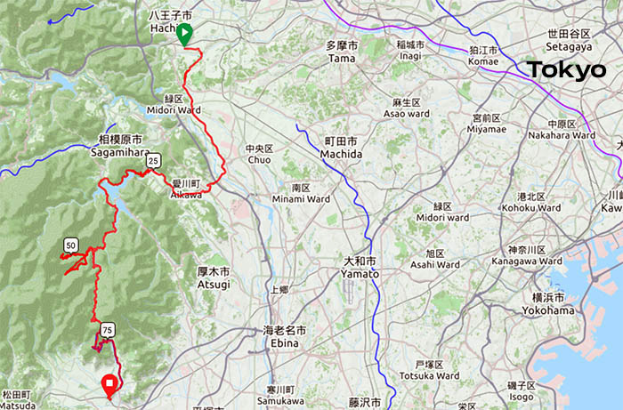
Yabitsu Pass is popular with cyclists, because it’s close to the capital, and yet it traverses a mountain range that is far off the beaten path. You could ride there from central Tokyo, but I decided to take the train for the first leg of the ride. Not only does this save time, but it keeps navigation simple. The way I did it, the ride across Yabitsu Pass has only three or four turns where one could get lost.
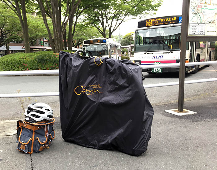
An hour’s train ride from the center of Tokyo brings me to Takao at the foot of the mountains. The first thing I do is un-Rinko my bike – remove the carrying bag and assemble it.
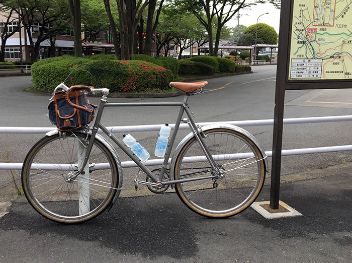
Twelve minutes later, I am ready to roll. My ‘Mule’ currently lives in Japan. It’s nice to have a bike waiting for me when I arrive – a bike that can handle anything from a fast group ride to loaded touring.
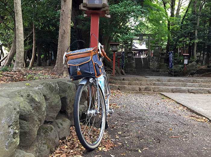
Heading out of town, I stop at my favorite shrine for a moment of contemplation. As is the Japanese custom, I pray for safety on the road. It reminds me to be careful and not take undue risks as I head out for an adventure.
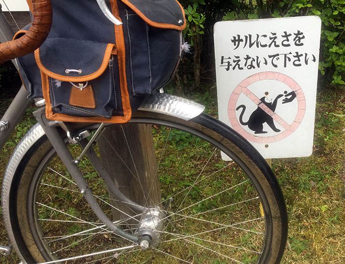
After riding through suburbs for a while, I enjoy the short, steep climb to Lake Miagase. The lake is formed by a large dam, and I have to climb that elevation all at once, with a gradient that feels like 18%. My Japanese is making only slow progress, but I don’t need to read Kanji to understand what this sign says. Alas, no cute monkeys are visiting the park today.
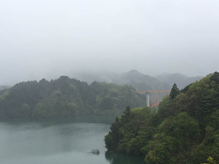
My effort is rewarded by a breathtaking view across Lake Miagase. Today the mountains are shrouded in mist. The weather forecast predicted a 20% chance of showers. Usually, Japanese forecasts are very accurate, since they rely on very advanced technology. So I hope that the rain I see falling on the lake is just one of those ‘showers.’
From here, the route is heading into the mountains. I follow the beautiful road that skirts the shore of the lake.
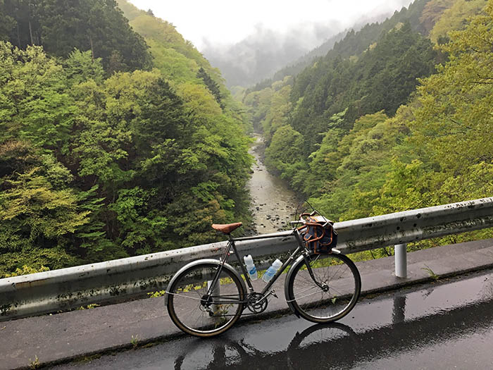
When I reach the rugged valley that leads to Yabitsu Pass, rain starts falling in earnest. It’s not typhoon season, but it doesn’t feel all that different, except the rain is colder. I am glad the ‘Mule’ has generous fenders and a good mudflap. I am getting wet from above, but there isn’t the constant barrage of spray that can chill legs and feet to the bone. I am carrying enough clothes in my handlebar bag to deal with any conditions, as long as I keep moving: wool tights, extra layers and a rain shell. For emergencies, I carry a space blanket. It’s not so much equipment that it’ll slow me down, but it’s enough to be prepared.
The road to Yabitsu Pass is an all-time favorite. The first part is almost level as it goes along the lower reaches of the river. Curve follows after curve, and on a well-handling bike, it’s great fun.
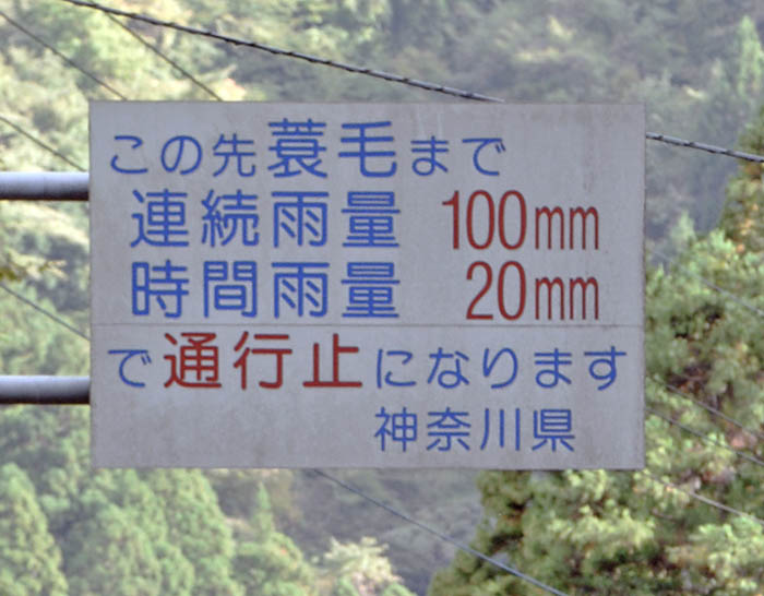
Despite my limited Japanese, I do know the Kanji for rain: 雨. This sign indicates in the third line that if more than 20 mm (0.8″) of rain fall in one hour, the road will close. (The second line says that if 100 mm/4″ fall without a dry spell, it’ll close as well.) In this steep terrain, the danger of mudslides is ever-present. Today, I hope it won’t come to that!
Just before the real climb to Yabitsu Pass starts, there is a side road that I have been wondering about. I’ve been making good time today, so this seems like good an opportunity to explore it.
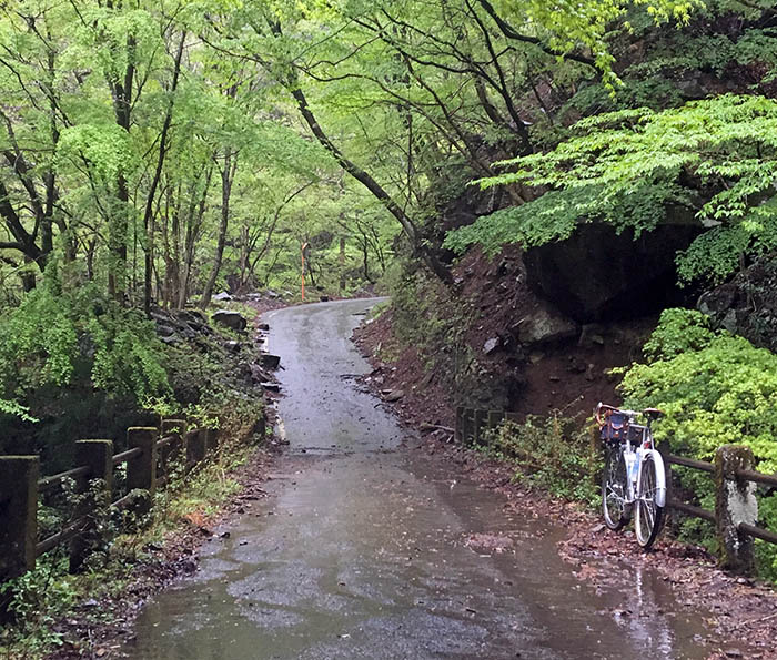
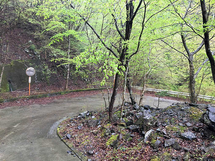
The road is closed to motorized traffic with a big gate, but it seems that bikes are allowed. At another fork in the road, I turn left and go up a beautiful valley.
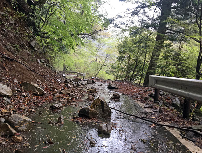
Soon I discover why the road is closed: Rockfalls have made it impassable for cars. No problem on a bike, but wide tires are a plus to avoid pinch-flats.
A big tree has fallen across the road. It’s only a minor obstacle. On wet and slippery ground, it’s not advisable to jump, cyclocross-style, so I take it at a more cautious pace. Click on the arrow to watch the video clip I took with my cell phone propped on a rock.
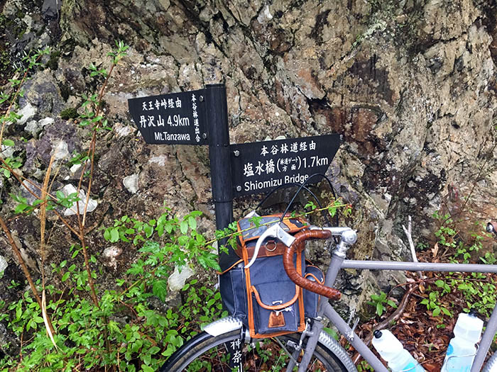
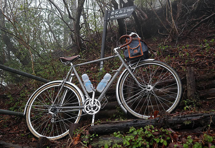
I pass a sign for Mt. Tanzawa. A hiking trail scales the steep valley side. I continue on the road, until it ends where another rockfall has completely obliterated the road. Time to turn around and explore the other fork…
The second road is steeper as it climbs the ridge between two valleys. The climb has a nice rhythm, and I am having a good day. The ‘Mule’ and I get in sync, and the gradient feels much less steep than it probably is.
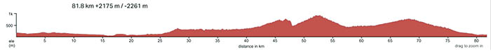
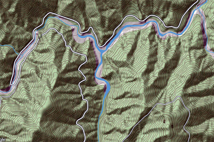
When I chart the ride on RidewithGPS later, I am surprised how the two sidetrips each climb higher than the actual pass! (The steep downhill after the first climb is an artifact of my drawing a straight line on the map – the software doesn’t follow the closed road.)
The road climbs higher and higher in switchback after switchback. It is fun, and I’m working so hard that I don’t even notice the rain any longer.
The top comes almost unexpected. It’s another trailhead for Mt. Tanzawa. It feels like I’ve climbed the 1567 m (5,141′) mountain from both sides. For a moment, I think of a passhunting adventure. I could hike with my bike to the top, then down the other side. Maybe another day!
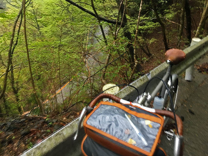
The downhill is wet. Very wet! On the steep slope, I drag my front brake continuously, so my rims stays warm enough to evaporate the rainwater that otherwise would coat it and compromise my braking. That way, I can brake for the hairpin turns. In conditions like this, powerful brakes are important. If your brakes are marginal in the dry, they cannot cut through the film of water that builds up on the rims when you ride in the rain. No problem with the Mule’s centerpull brakes, though.
When I return to the main road, I am starting to get cold. Fortunately, the gradual uphill invites an all-out effort. That is why it’s so popular with racers. Pushing myself and my bike to our limits, the curving road is great fun. Where sightlines allow it, I don’t slow for the bends, but use the entire road. At times, I have to brake for the curves, even through the road is heading uphill.
There is no traffic at all. The rain is pelting down, obliterating all other sounds. I remember the sign at the bottom of the pass and wonder whether it has rained more than 20 mm in an hour, and the road has been closed. It doesn’t matter – it’s too late to turn around.
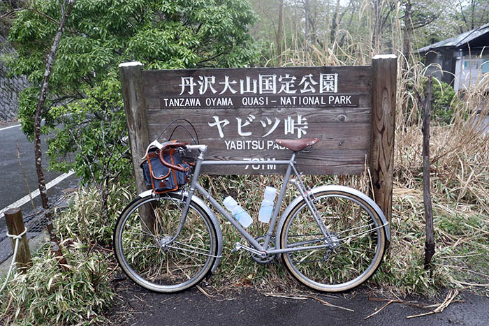
As I reach the last, steep kilometer before Yabitsu Pass, I can feel the effort in my legs. I give it everything I have and reach the pass without slowing. Getting here feels like a real achievement today. The pass is deserted on this rainy weekday.
Now all I have to do is coast down the other side to the train station at Hadano. No more photo stops – I need to get down the steepest part of the descent before my body has a chance to get chilled. Knowing the road from previous rides is a big advantage today. The turns are more flowing here, so I can let the bike roll at speed. It’s fun and fast. I crouch in a low tuck, not to go faster, but to decrease my exposure to the cold air rushing over me.
Then I reach the station. I Rinko my bike and get on the train. I am back in Tokyo for dinner.
If you find yourself in Tokyo looking for a great ride, I recommend Yabitsu Pass. It’s scenic; it sees little traffic (albeit a bit more on sunny weekends); and navigation is easy. The two optional out-and-back side trips add to the challenge if you feel so inclined.
The ride across Yabitsu Pass in numbers:
- Distance: 66 km (42 miles)
- Elevation gain: 1300 m (4265 ft)
- Two extra climbs add about 30 km (19 miles) and 900 m (3000 ft)
- Link to map on RidewithGPS
