

Bicycle Quarterly Un-Meeting Routes
After last weekend’s ‘pre-ride,’ we’ve finalized the routes for the Bicycle Quarterly Un-Meeting. What is the Un-Meeting?
It’s simply a great weekend of riding off the beaten path: Everybody is welcome to join us. We publish a time and a destination. Beyond that, there are no services provided. No registration, no entry fee, no sag wagon, no rest stops. Just a ride with old and new friends. Click here for more about the 2018 BQ Un-Meeting.
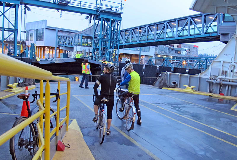
We’ll meet in Bremerton, across the Puget Sound from Seattle, Washington. Most of us will take the 7:35 ferry from Seattle. Make sure you board the boat to Bremerton; not the ferry to Bainbridge that leaves from the same terminal.
When: Sept. 8-9, 2018 (Sat. & Sun.)
Meeting point: Bremerton, Washington, Ferry Terminal exit (Starbucks Coffee shop)
Meeting time: 9:30 a.m.
Ride distance: Day 1: 100 km (62 miles), Day 2: 35 km (22 miles) with options to go further.
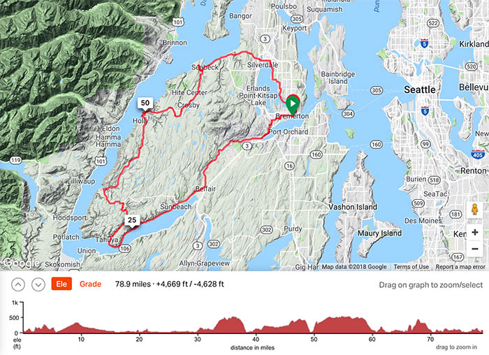
From Bremerton, we’ll ride around the Hood Canal to Seabeck, where most of us will camp at Scenic Beach State Park. We have campsites reserved for about 24 people, but if you prefer, you can use other accommodations. Above is the suggested course. Click on the image to get the RideWithGPS page, where you can zoom in and check the course in detail. (A route sheet is at the bottom of this post.)
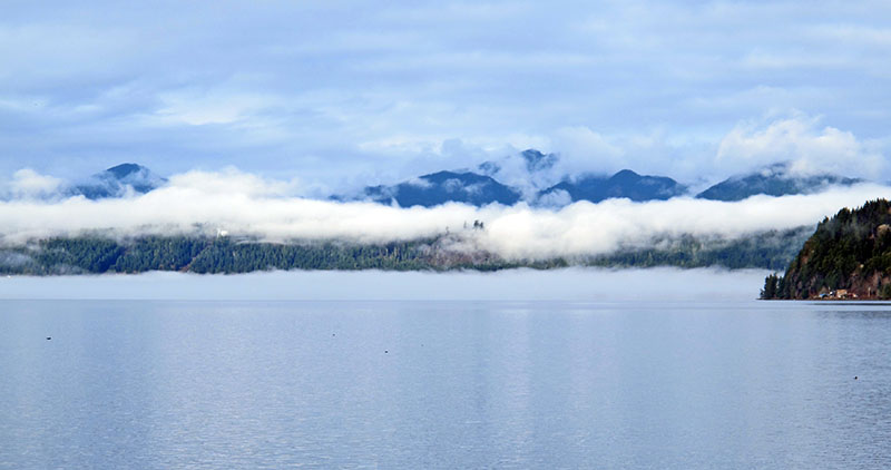
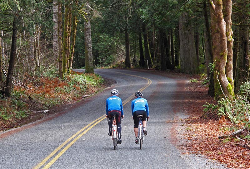
It’s a beautiful route with quiet roads along the waters of the Hood Canal, a fjord carved by the glaciers of the last ice age. We’ll enjoy great views of the Olympic Mountains. It’s a truly magic place.
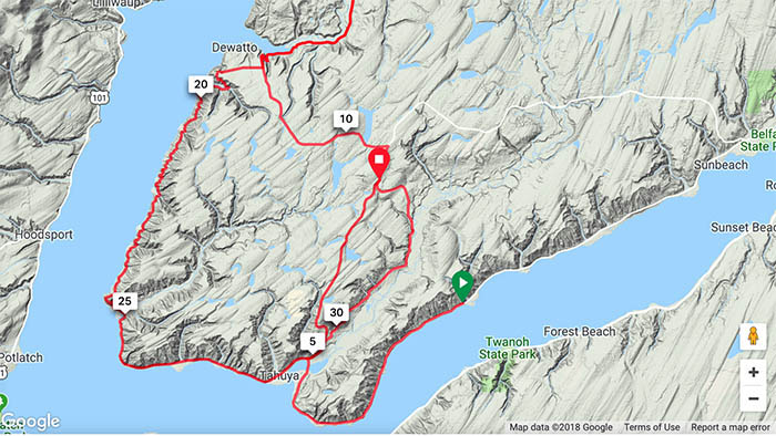
Then we reach the Tahuya Hills, where we have three alternative routes. To put them all on the same map, I pretended to go back and forth across the Tahuya Hills three times. That is why the distances seem odd… All three routes gain a similar amount of elevation, and yet they feel very different.
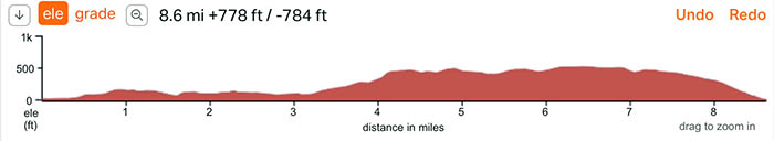
The easternmost route (right red line on the map) is the paved ‘River Route.’ It’s a great choice if you prefer to get into a rhythm on longer climbs.
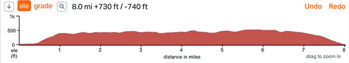
The ‘Hill Route’ is in the center. The total elevation gain is similar, but it’s a different riding experience. The first climb is very steep, but from there, you have a wonderful rollercoaster. If you like to carry speed across rolling terrain, choose this route. The two routes converge at Mile 3.6, so you’ll enjoy the same ride back to the coast.
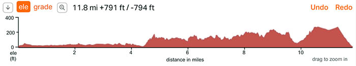 The western ‘Gravel Route’ is very different in feel. It’s longer, so in theory, it has less climbing per mile. In reality, it’s the hardest of the three. The climbs are short and steep, and there are many of them.
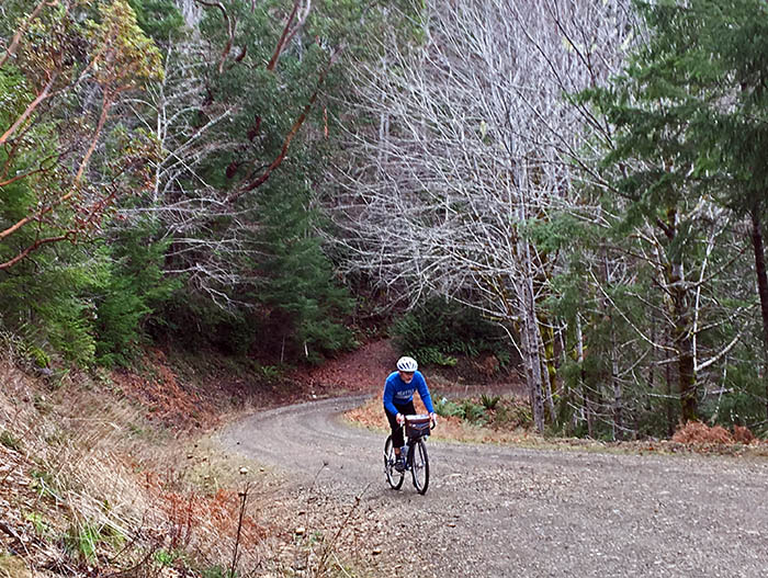
And most of it is on gravel. At the end of the summer, the gravel tends to be hard-packed, with loose aggregate on top. Even if you are a good bike handler, use caution, because the surface is tricky. And there is one steep descent where you need to watch your speed to make the turn at the bottom.
Which one to pick? They are all nice – you can’t go wrong!
After camping in Seabeck, there are many options on Sunday. The route on the main route sheet (top photo) is the shortest way back to Bremerton, and you could be in Seattle by lunchtime.
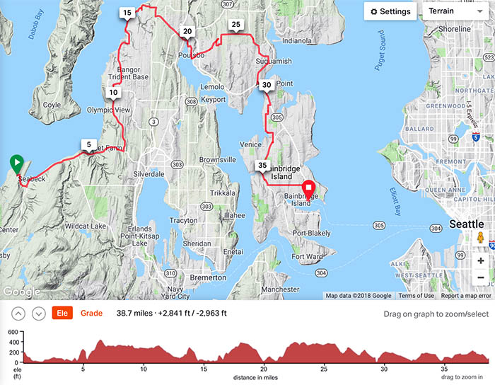
Many of us will extend the ride and go to Poulsbo and then take backroads to Bainbridge Island, and take the ferry back to Seattle from there. The above route is just a rough draft – I haven’t ridden all of it, and we may have to alter it as we go.
Some riders probably will use the Un-Meeting as a jumping-off point to explore further. There is great riding toward Port Townsend on the Quimper Peninsula. And the vast Olympic Peninsula invites exploring places like Bon Jon Pass…
We’re looking forward to riding with many of you in less than two weeks!
More information:
