

Fuji Super Randonnée 600 km
I like climbing, and I like mountain scenery, so I was excited when the Audax-Club Parisien introduced the Super Randonnée 600 (SR 600) brevets a few years ago. The idea behind the SR 600 is simple: Over 600 km (373 miles), the route climbs at least 10,000 m (33,000 ft). The best courses for me are not pure climb-fests, but beautiful routes with a good rhythm of climbing and descending.
The Super Randonnées have taken off in Japan – little wonder in a country with so many mountain roads. A year ago, Hahn and I attempted the Nihon Alps SR 600, but had to abandon at the half-way point due to a variety of factors, not least the navigation problems when we could not read the cue sheet and our phone’s GPS stopped working (BQ 51).
This autumn, while staying in Japan, I wanted to make another attempt at completing a SR 600. Unfortunately, the Nihon Alps route is currently interrupted by a landslide on Iida Pass, so I opted for the Fuji SR 600 instead. This route includes more than 11,000 m of climbing, so you get an extra 2 hours beyond the standard 50 hour time limit. 600 km in 52 hours – that should be do-able!
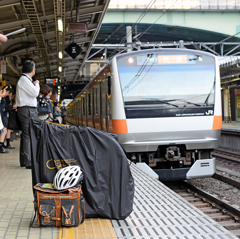
I brought the “Mule”, my Rinko bike, to Japan. Like the Japanese, I took the train to the starting point with my bike in its Rinko bag.

An hour after leaving Tokyo, I assembled my bike at the Takao train station and started my ride. The first part went through relatively densely populated areas. This time, I had opted to bring a GPS system. Fellow randonneur Tak Kawano had helped me set up the Fuji SR 600 route.
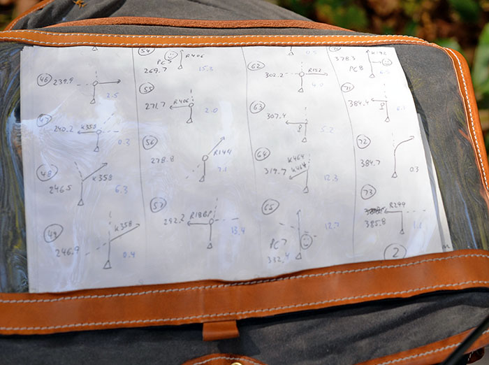
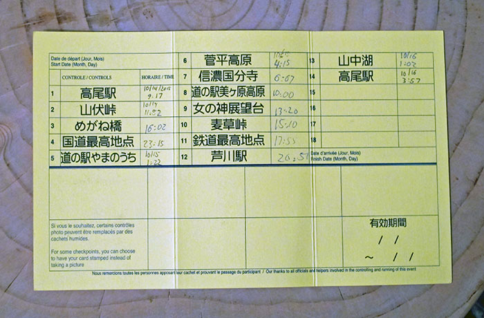
In addition to the route sheet (which was all in Kanji), the organizers’ web site had pictograms for each change of direction. Lacking a printer, I copied them onto several pieces of paper. A little over 100 turns seemed manageable for that long a ride.
I often think of music when describing cycling routes. Rolling courses can be light-hearted like a Schubert Waltz, mountainous ones often have the drama and pathos of a Beethoven symphony. The Nihon SR 600 course reminded me of the modern composer Stockhausen, with a disjointed rhythm that was hard to discern. Just like Stockhausen’s music probably puts exceptional demands on the skills of performers, I found the Fuji SR 600 to be an exceedingly challenging ride.
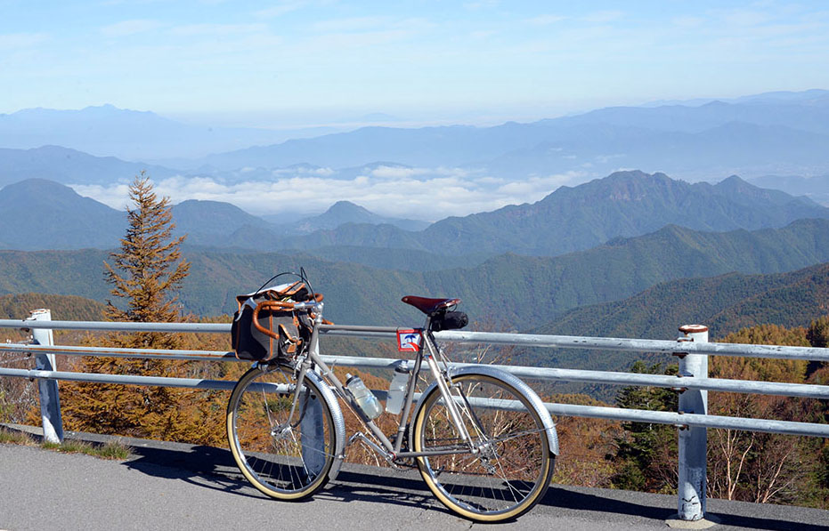
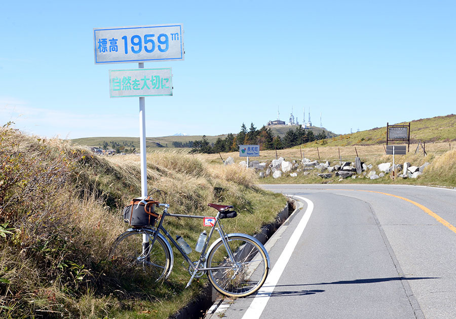
The first 125 km included a very nice mountain pass (above), but otherwise were mostly flat. How could this be on a Super Randonnée 600? Simple math dictates that the course had to climb at an average of 3.7%, if one assumes that half of it is up, and half is down! I already had covered more than 20% of the distance, and yet hadn’t really started climbing yet.
The answer became apparent during the first night, which turned into a surreal, vertiginous ride that went from almost sea level to more than 1800 m (6000 ft) – multiple times.
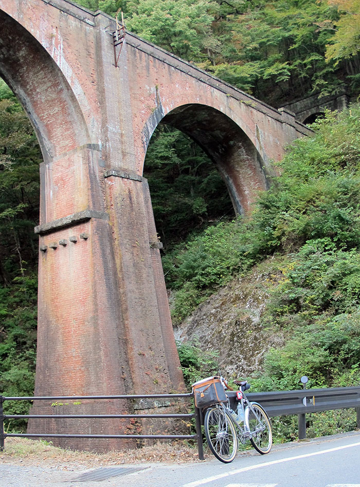
It started with a very nice, 25 km-long climb. SR 600 rides have control points where you take a photo of your bike, complete with the red-and-white SR 600 plate. Control Point 3 was this amazing viaduct. It’s incredible to me that a railroad used to go up this huge mountain pass!
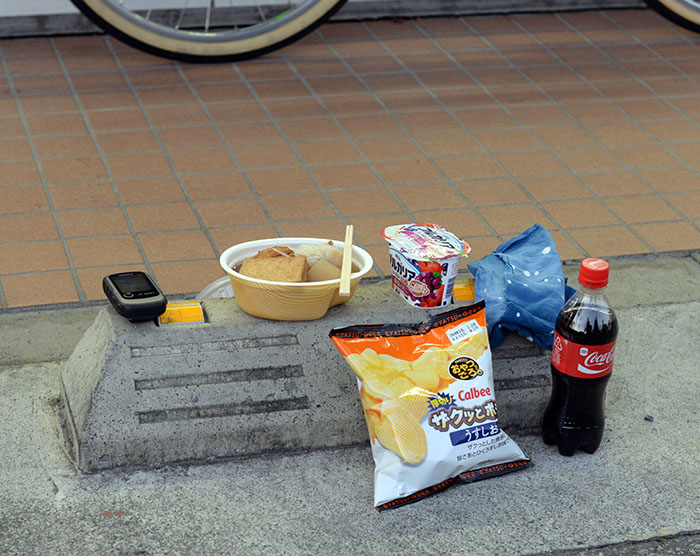
Night had fallen by the time I reached the top. I stopped at a convenience store to eat dinner. Japanese convenience stores offer a decent selection of deli foods, so this was no hardship.
Then the climbing started in earnest. I went up and up for hours, then down at incredible speeds, before launching straight into the next climb, over and over again. I passed through a town built around Onsen hot springs that smelled like sulphur, then climbed a few hours more. Sometimes the gradient was so steep that I had to rise out of the saddle. Most of the time, I worked hard to crank my smallest gear. This is where the course was making up for the flat portion during the first part of the ride!
Without much rest, my legs were getting tired.
The night was clear, but there was no moon. As I gained elevation and left the trees behind, I saw an incredible panorama of stars. The Milky Way stretched almost from horizon to horizon.
There was hardly any traffic, but when a car passed me, I got to experience a “musical road”. Tiny grooves had been cut into the road, perpendicular to the direction of travel, at varying intervals. When a car went over these grooves, the tires made high-pitched sounds. If the car went at the recommended speed, it all coalesced into a recognizable piece of music. Only in Japan! It added to the surreal effect of the ride.
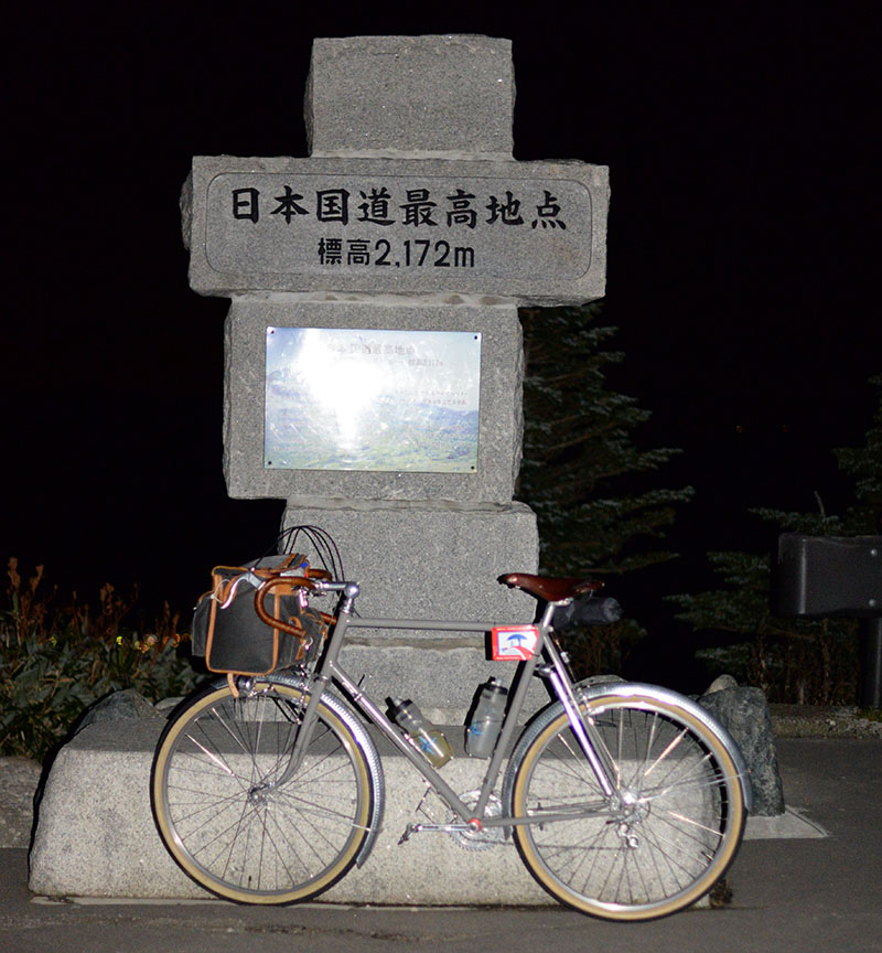
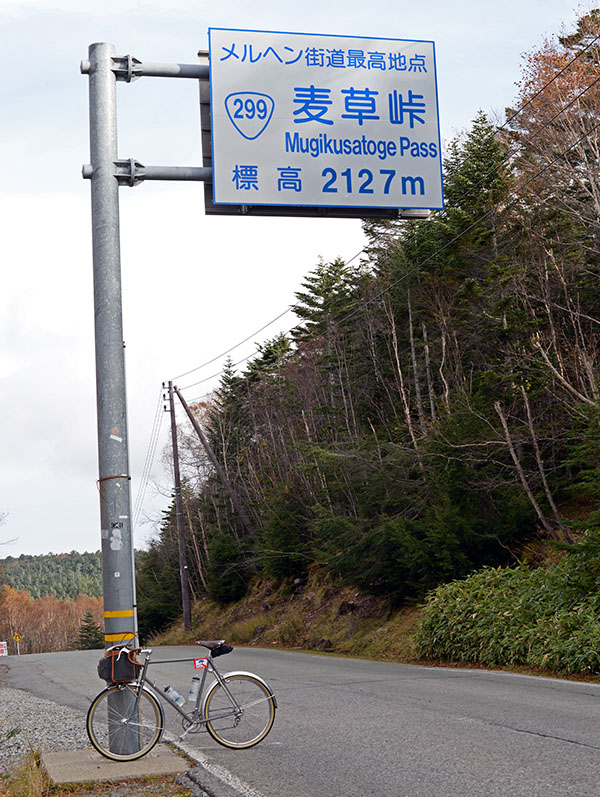
When I reached the highest point (above) in the early morning hours, I saw a sign indicating a temperature of -1°C (30°F). I had 1600 m (5200 ft) of vertical descending ahead. I didn’t waste much time at the top. I donned all the clothes that I had removed during the steep climb before launching into the abyss.
The cold air and lack of pedaling made me sleepy. Once I reached lower elevations, I stopped at the first convenience store, ate, and then napped for an hour.
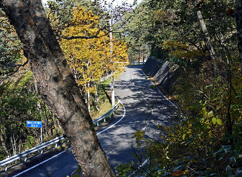
The next day saw another climb above the clouds. This was another beautiful road, frequented mostly by sports cars. When a car passed me every ten minutes or so, there was a 50% chance that it was a Porsche, Lotus, older Nissan GT-R or other interesting machine, all driven respectfully.
A few hours later, I was on top of the world again, with a view down onto clouds and mountain ranges (photo at the top of the post).
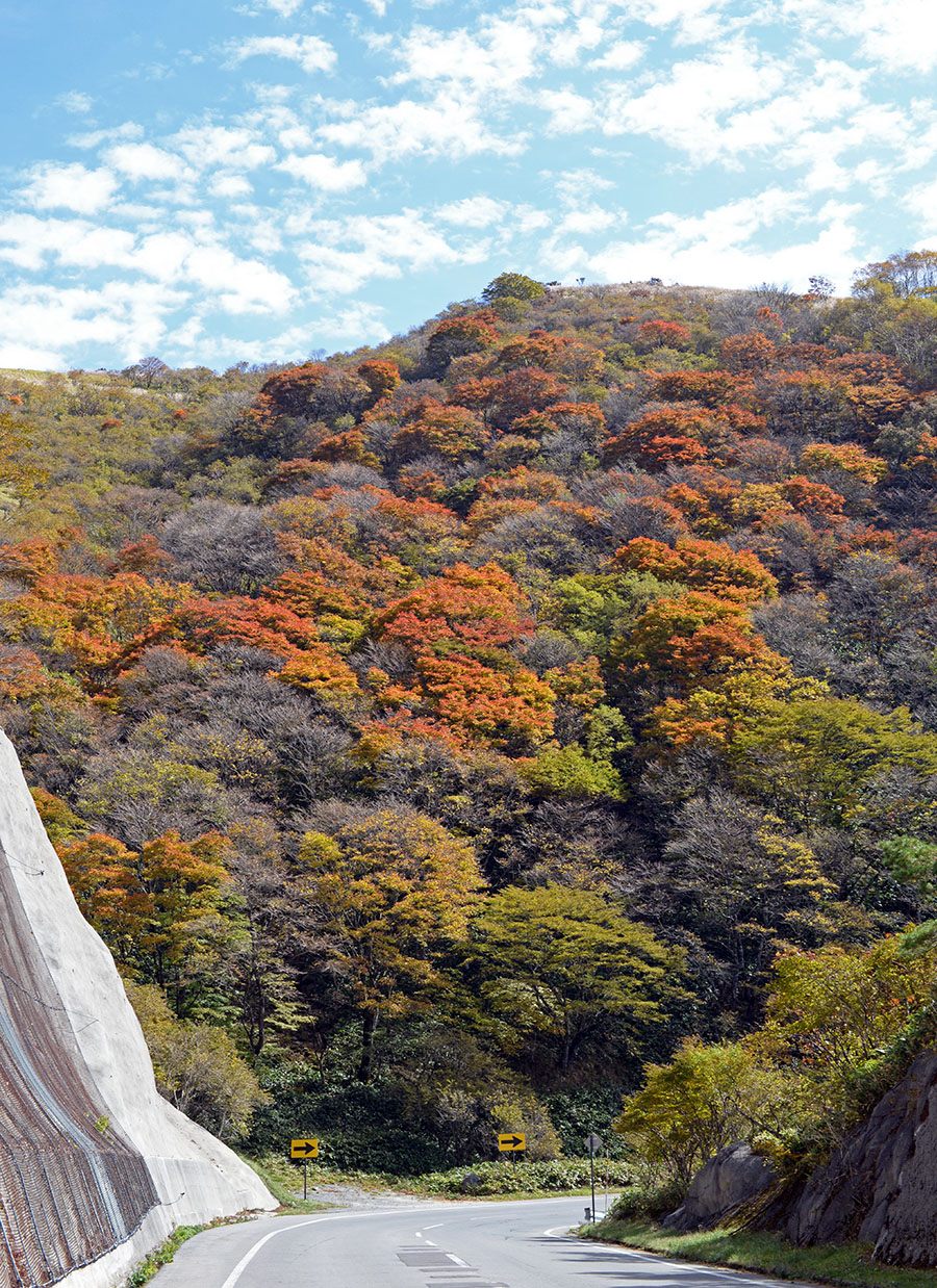
The descent was amazing, with the autumn colors out in full force. What followed were a long set of rollers, for lack of better word, except that each roller was 3 miles long and climbed rather steeply. By now, my legs were most definitely getting tired.
When I pined for a cold drink, I followed signs to a small pass slightly off the course, surprised to find a full restaurant. Two old ladies were cooking, and in my broken Japanese, I asked them what would be quickest. Almost immediately, they brought a steaming bowl of soba. What a great second breakfast!
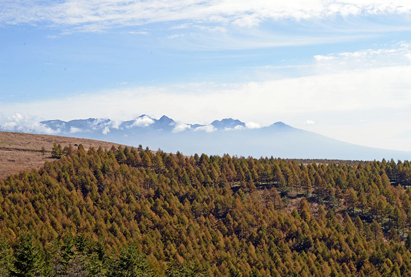
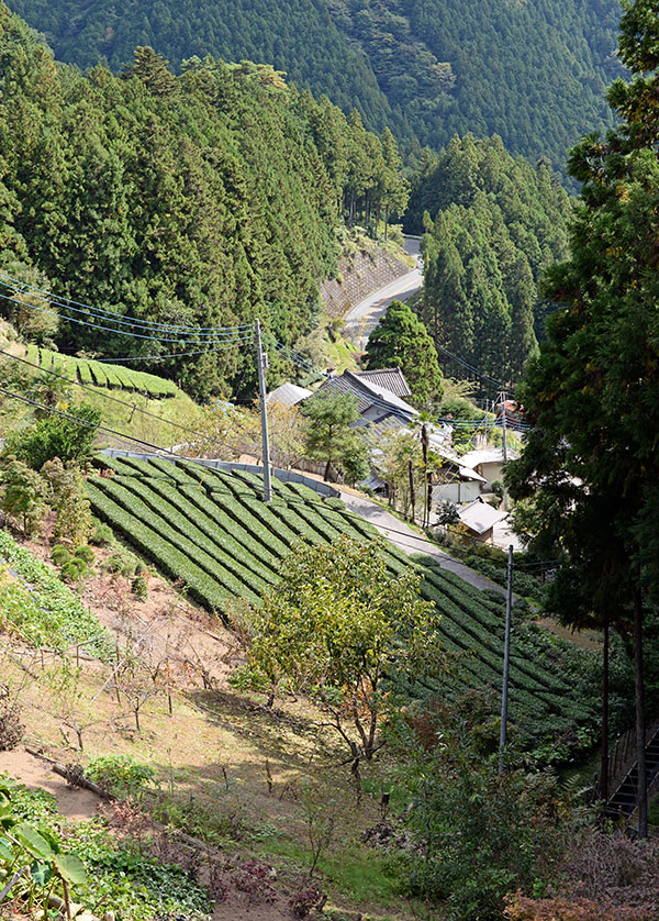
The relentless up-and-downs took me to the Yatsugatake Mountains. This volcanic range is one of my favorite landscapes in Japan. Its dry, loose soil makes for a more open landscape and more even gradients. It’s an area of grand vistas and great roads.
Night was falling again when I reached the second-highest pass of the ride. The exhilarating descent went through switchback after switchback. Then the course joined a major highway that wound its way through the mountains. Without warning, the road plunged downhill for another 25 miles (40 km). In the dark, I jockeyed for position with cars while coasting downhill at probably more than 60 km/h (40 mph) for more than 30 minutes. It was intense!
I was glad to reach Kofu and start a long tour of this major town, fortunately on backroads. Now in the second night of my ride, a beautiful climb up a deserted river valley was greatly enjoyable. A surreal element was an abrupt mile-long, brightly lit tunnel that was totally deserted, which brought me to the high-elevation lakes on the flanks of Mount Fuji.
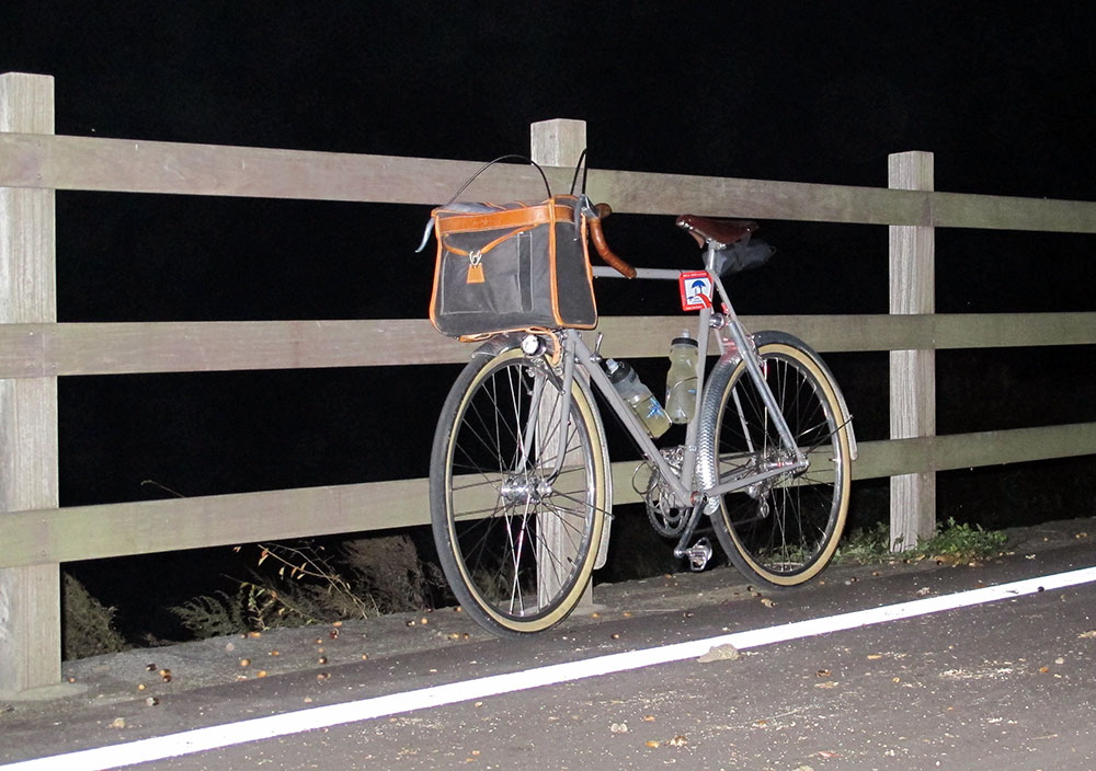
The Fuji SR 600 derives its name from the fact that it circles Mount Fuji. At Lake Yamanaka, I was supposed to take a photo of my bike in front of the majestic volcano. In the pitch-dark night, all I could do is position my bike in front of the characteristic fence, and hope the ride organizers would accept this as proof of passage.
I traversed yet another small mountain pass, and then entered the final descent. Hahn and I had ridden this road during our first visit to Japan (BQ 48). It was even more fun at night, since there was hardly any traffic. I freewheeled for most of the next 45 km (28 miles) as the road lost almost 1000 m (3300 feet) of elevation, punctuated once in a while by a short burst of effort to crest a roller.
It was starting to rain as I approached my goal, but it didn’t matter any longer. I had intended to catch the last train from Takao to Tokyo at midnight, but instead, I was on the first train in the morning, at 4:30. I had just enough time to Rinko my bike and eat a little before I boarded the train back to Tokyo and fell asleep, just like many of the early commuters.
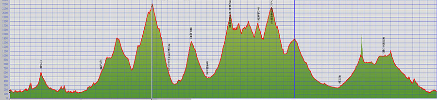
It took me 42:40 hours to complete the course – more than the Volcano-High Pass SR 600 that includes 110 km of gravel roads; more than the Raid Pyrénéen that climbs as high, but is more than 100 km longer. Why is the Fuji SR 600 so challenging?
I think it’s the rhythm – the climbing is concentrated in the middle portion, and it’s very steep. This means that you face the last third of the ride with tired legs. Add to that the cold nights in October, and it’s a true challenge. Each Super Randonnée 600 is different. They all are challenging, and you get a great sense of achievement when you complete one.
And for those not keen on riding almost non-stop, there is the Touriste version, which requires just riding 80 km (50 miles) a day, until you have completed the ride.
Further reading:
